Link to Greg Heberle homepage
Link to Doubtful History webpage (Phil & Sigrid Wellstead)
Link to Quaalup Homestead Wilderness Retreat
Link to notes on whaling at House Beach
Link to Heberle Fishing book & webpage
DOUBTFUL ISLAND BAY book (2016)
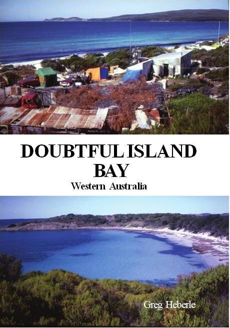
Greg Heberle published a 60 page book in 2016
PDF
of Front and Back cover (3.0MB)
PDF
of text and photos (6.0MB)
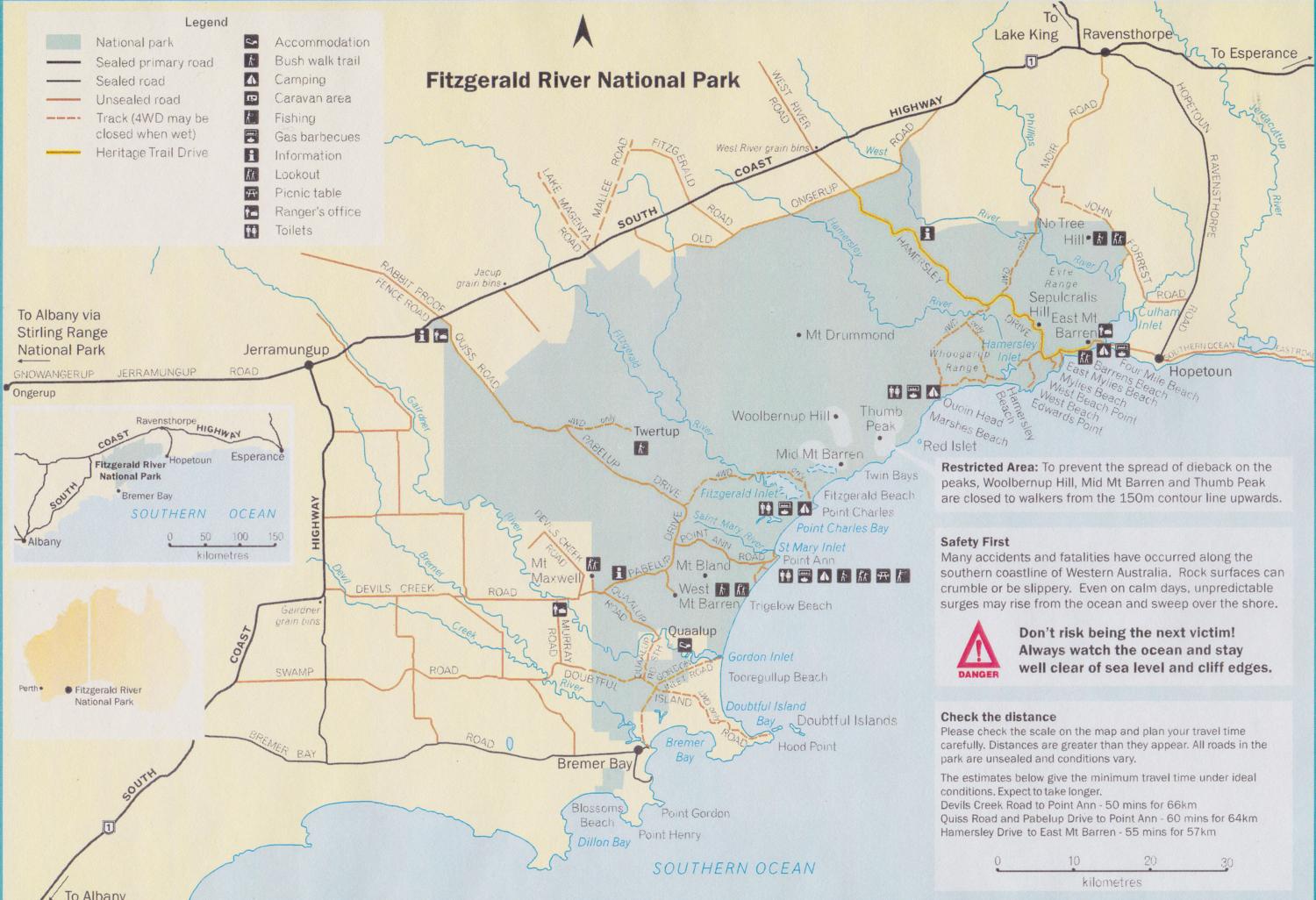
(1) LOCATION and ACCESS:
Doubtful Island Bay is located at about 34'20"S latitude
119'30"E longitude, some 12-15km in a straight line east and north-east
of Bremer Bay. See Map 2, which is appendix 5 in Heberle (2006).
Doubtful Island Bay is about 540km by road, south-east of Perth Post Office. One way there is Perth to Kojonup via Albany Highway, turn east to Broome Hill, then pass through Gnowangerup, Ongerup and Jerramungup. Travel south from Jerramungup and turn off South Coast highway either taking Devils Creek Road (just before Gairdner School) or continue to south past Gairdner School on Gairdner Road South to Bremer Bay Road, then east to Bremer Bay, see MAP 7. Rather than going through Ongerup and Jerramungup, another route is via Chester Pass Road, Borden and Borden-Bremer Bay Road to Bremer Bay and across the Bremer River sand bar (if passable) or via Swamp Road if not.
Vehicle access from Bremer Bay is across the Bremer River bar if the river is not running into the sea, then about 11km north on Gairdner (River) Road to the cross roads with Doubtful Island Road, then about 15 km south-east along the Doubtful Island Bay Road and track, depending on destination (to Trigelow Beach , House Beach, Reef Beach or Drages Beach), see AIR PHOTO 9.
When the river is impassible, access is westwards about 10km along bitumenised Bremer Bay Road, then north east along Swamp Road for about 12km (this section bitumenised 2012), then east along Doubtful Island Road, for about 33km, depending on destination (Trigelow Beach , House Beach, Reef Beach or Drages Beach), see AIR PHOTO 9.
Once Devils Creek Road is bitumenised to Fitzgerald River National Park (at 31 December 2014, about 30km from South Coast Highway to Quaalup turn off is bitumenised), the best access from Perth to Doubtful Island Bay might be via Devils Creek Road. Turn east off South Coast Highway 1 at Gairdner townsite, travel about 37km on Devils Creek Road and a short section of Pabellup Road, to the turnoff to Quaalup (turn south) along Quaalup Road. Travel about 15km, past Quaalup and the Gairdner River crossing to Doubtful Islands Road, then travel east along the Doubtful Island Road to the coast. See MAP 8. Note that Gairdner Road on MAP 1 is Quaalup Road on MAP 8.
MAP 1: Progress with roadworks:
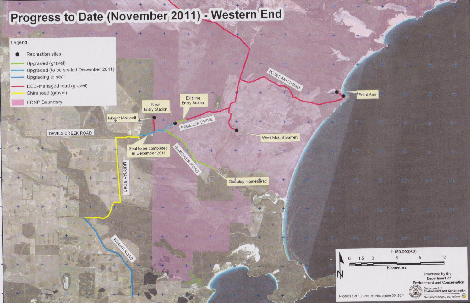
The Doubtful Island track comprises clay pans, which can be impassible in wet weather and sandy tracks which can be boggy when dry. The gravel roads can be very rough, as the sections nearer to Doubtful Island Bay are rarely graded. Access is by 4 wheel drive vehicles or trucks. By contrast, Fitzgerald National Park has many good roads, including some bitumenised, or soon to be bitumenised.
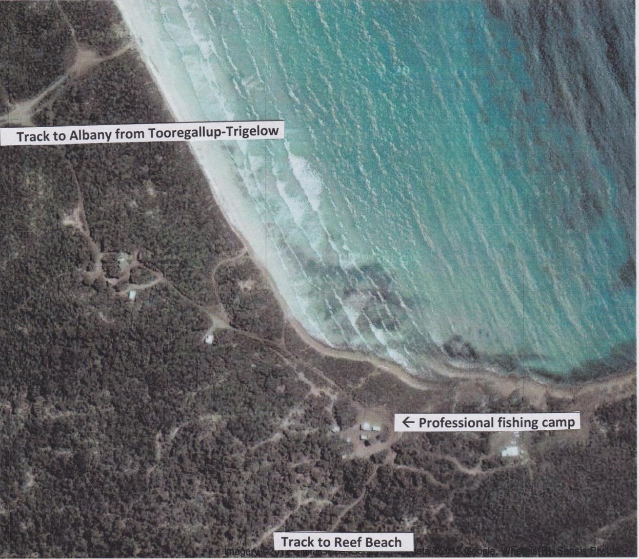
AIR PHOTO 1: Tooregullup-Trigelow
Beach
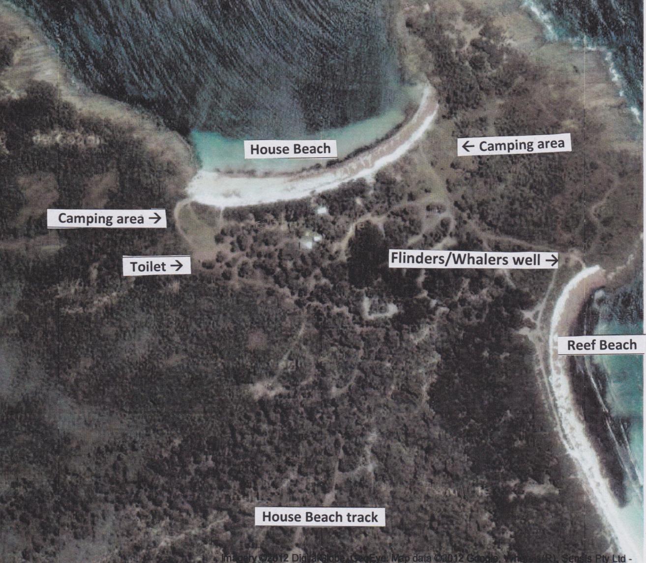
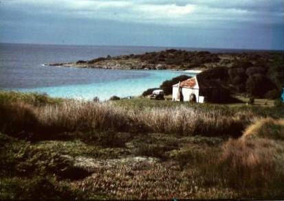
AIR PHOTO 2: House Beach
AIR PHOTO 3: Heberle camp
on Reef Beach
AIR PHOTO 4: Blowholes
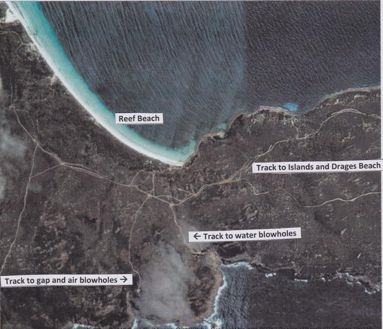
AIR PHOTO 5: Track to
Peppermint
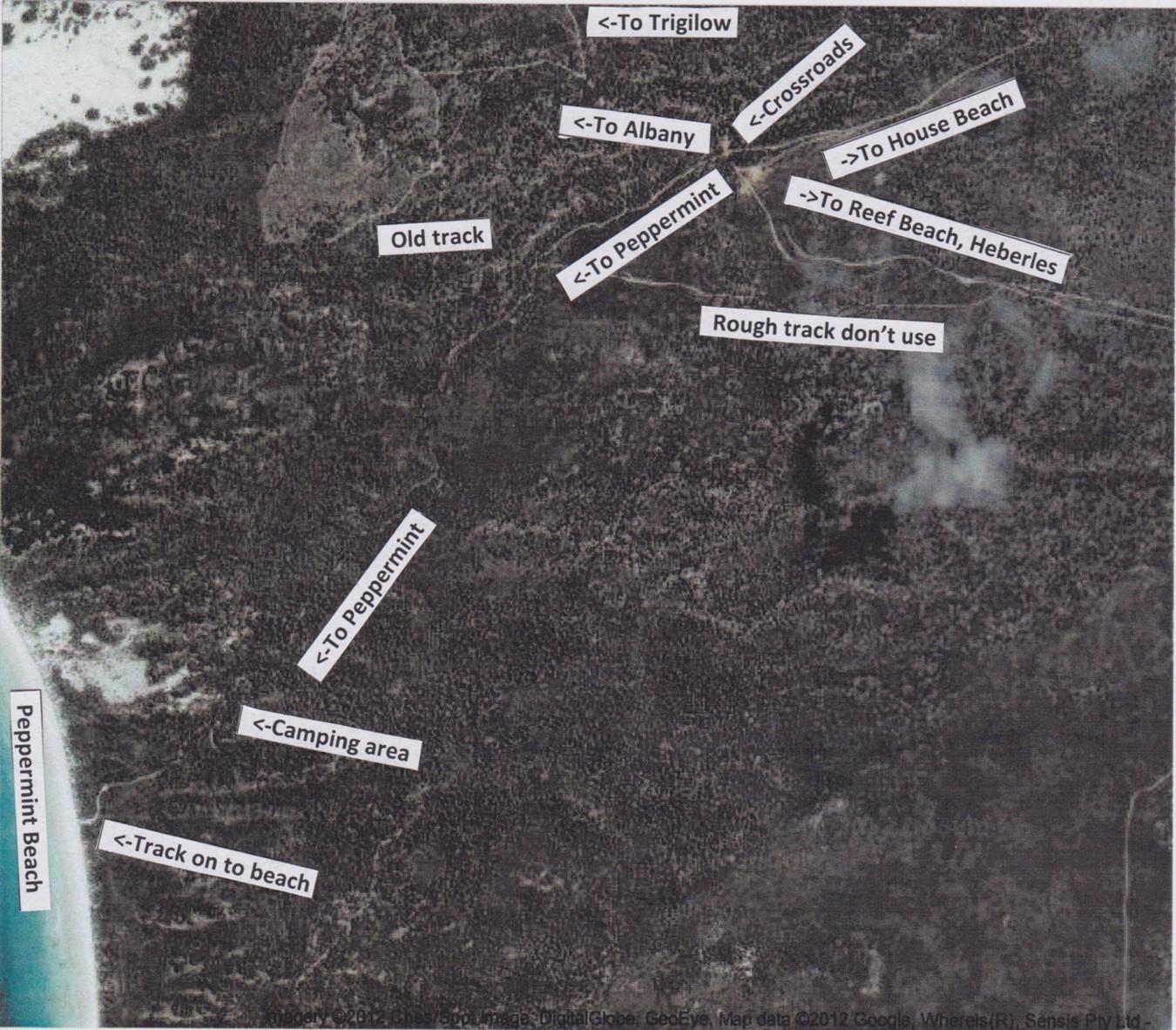
AIR PHOTO 6: Access to
Trigelow Beach, Peppermint Dam, Reef-House-Peppermint Beaches
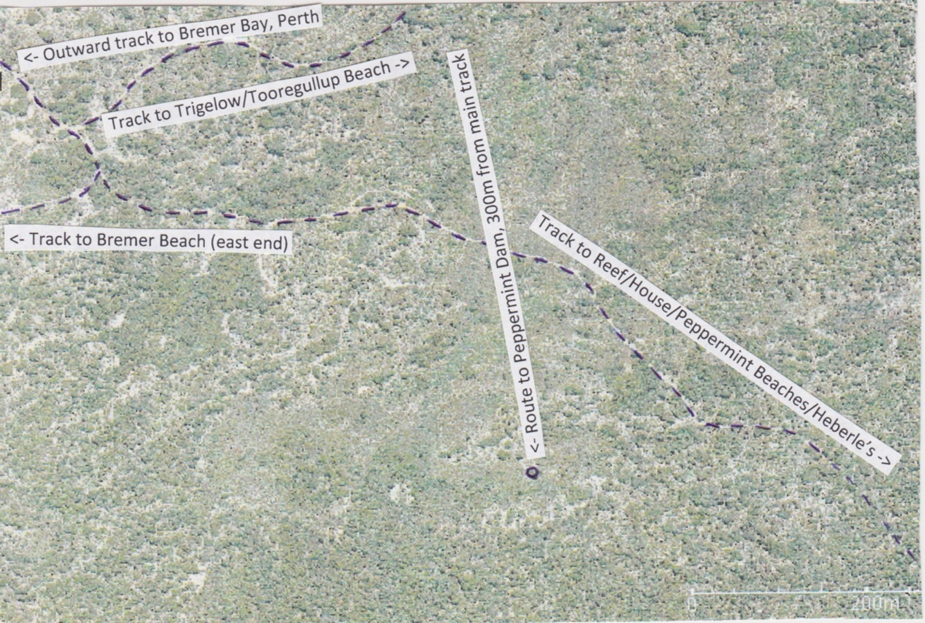
AIR PHOTO 7: Track from
Peppermint Beach (west end) to Bremer Beach (east end), Albany, Trigelow,
Reef Beach
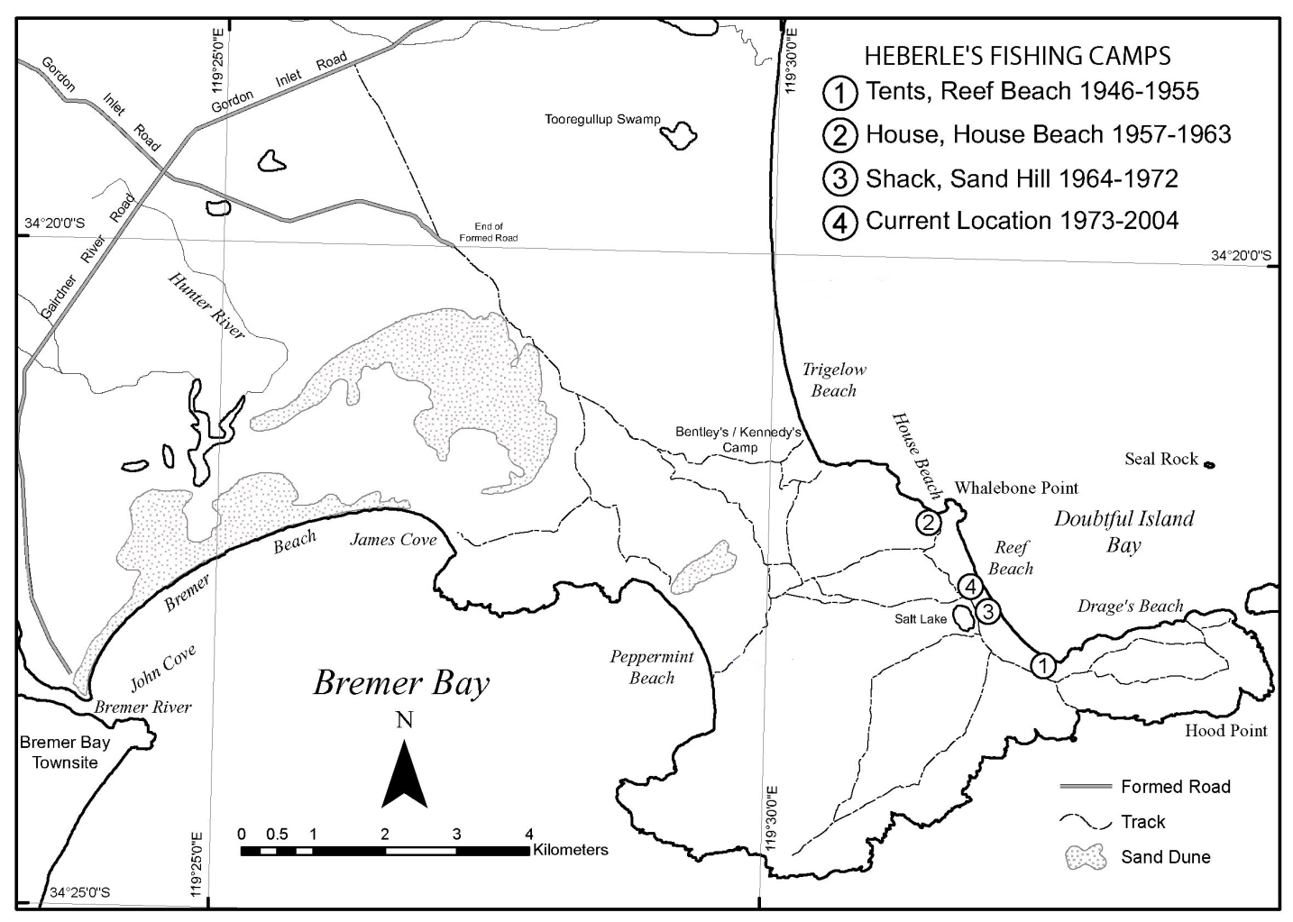
MAP 2: Tracks to Doubtful
Island Bay, Heberle's fishing camps (Appendix
5 in Heberle (2006). Note that some road names have changed since 2006.
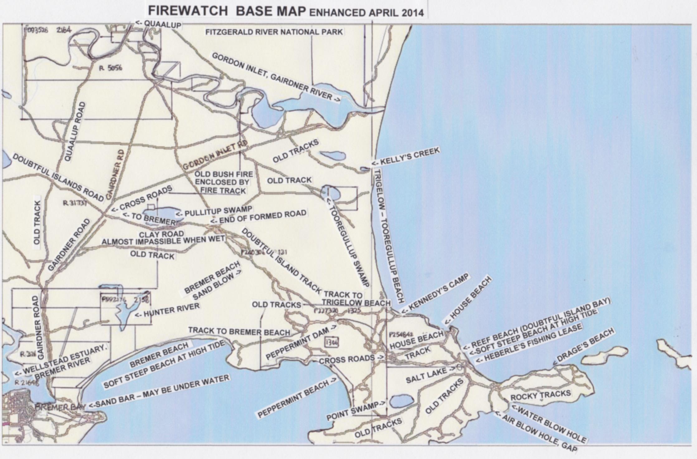
MAP 2A: Firewatch base
map, enhanced April 2014
MAP 2B: Doubtful Island
Bay 2015-Black & White
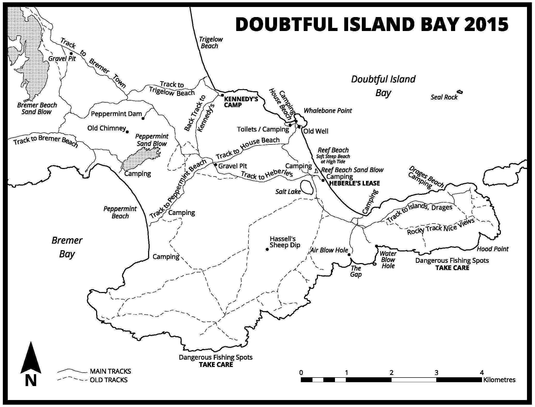
MAP 2C: Doubtful Island
Bay 2015-Colour

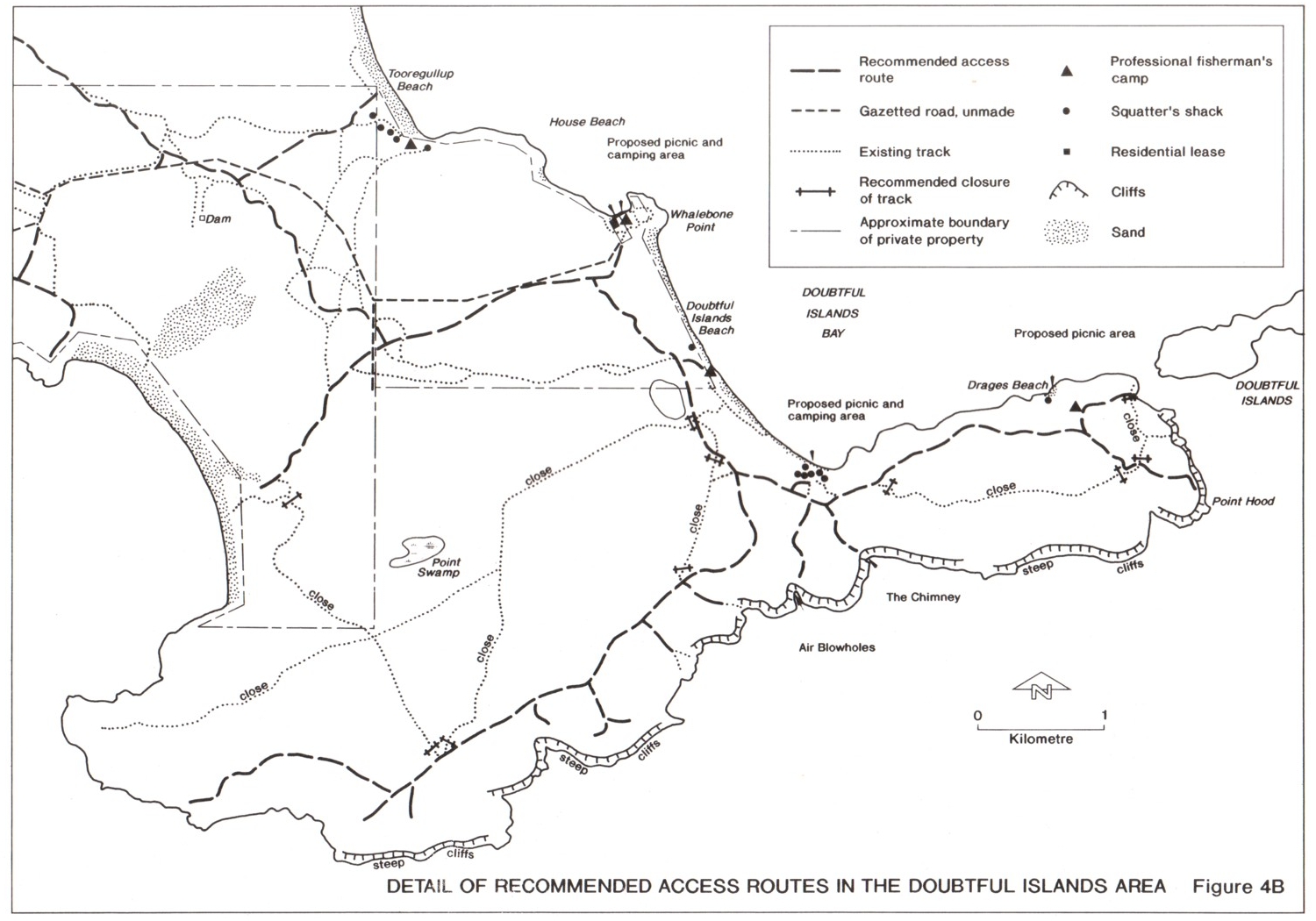
MAP 3: Figure 4B from
"Doubtful Islands Area Coastal Plan" (1994) showing recommended access,
proposed picnic & camping areas, professional fishermen's camps, squatters
shacks.
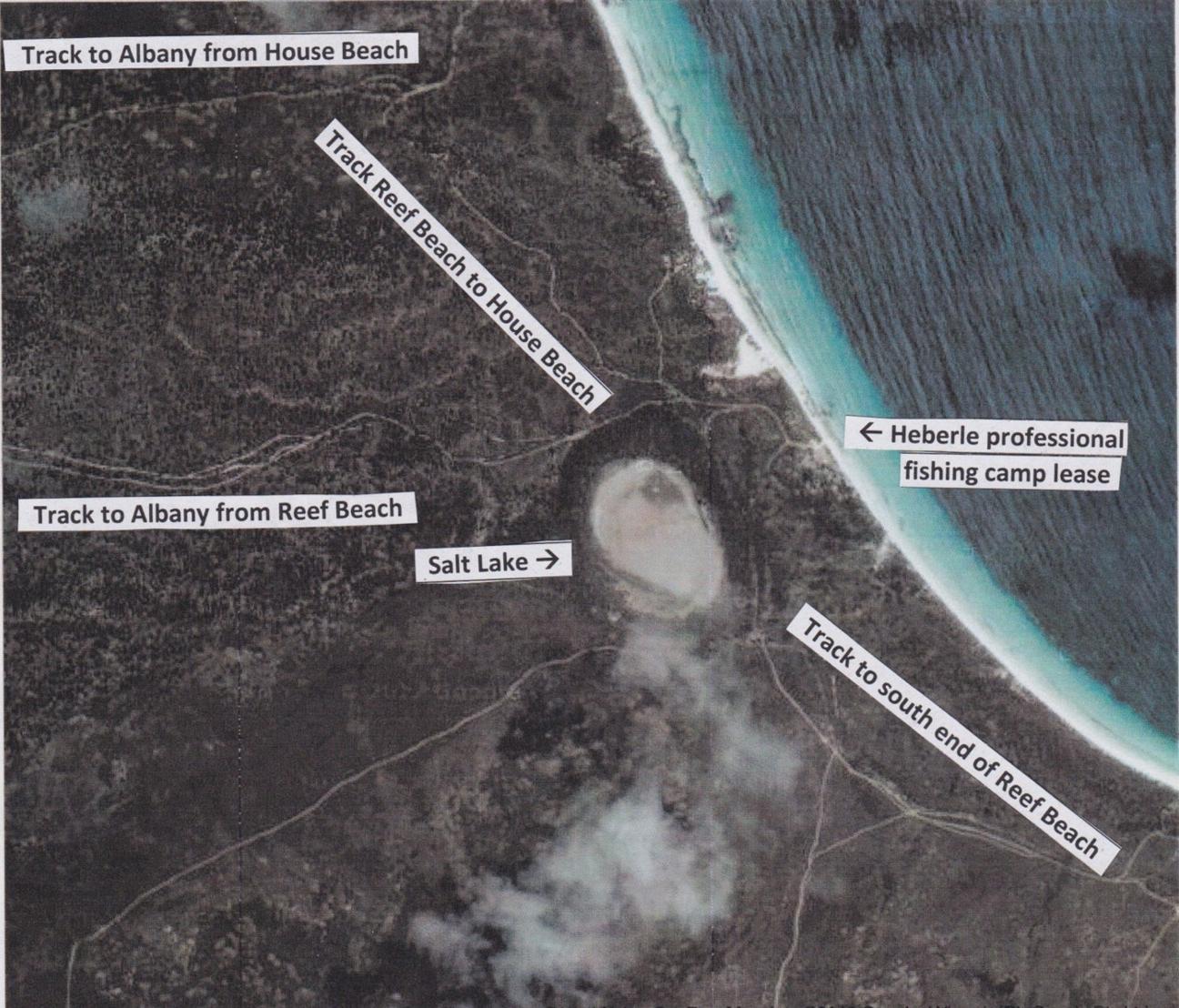
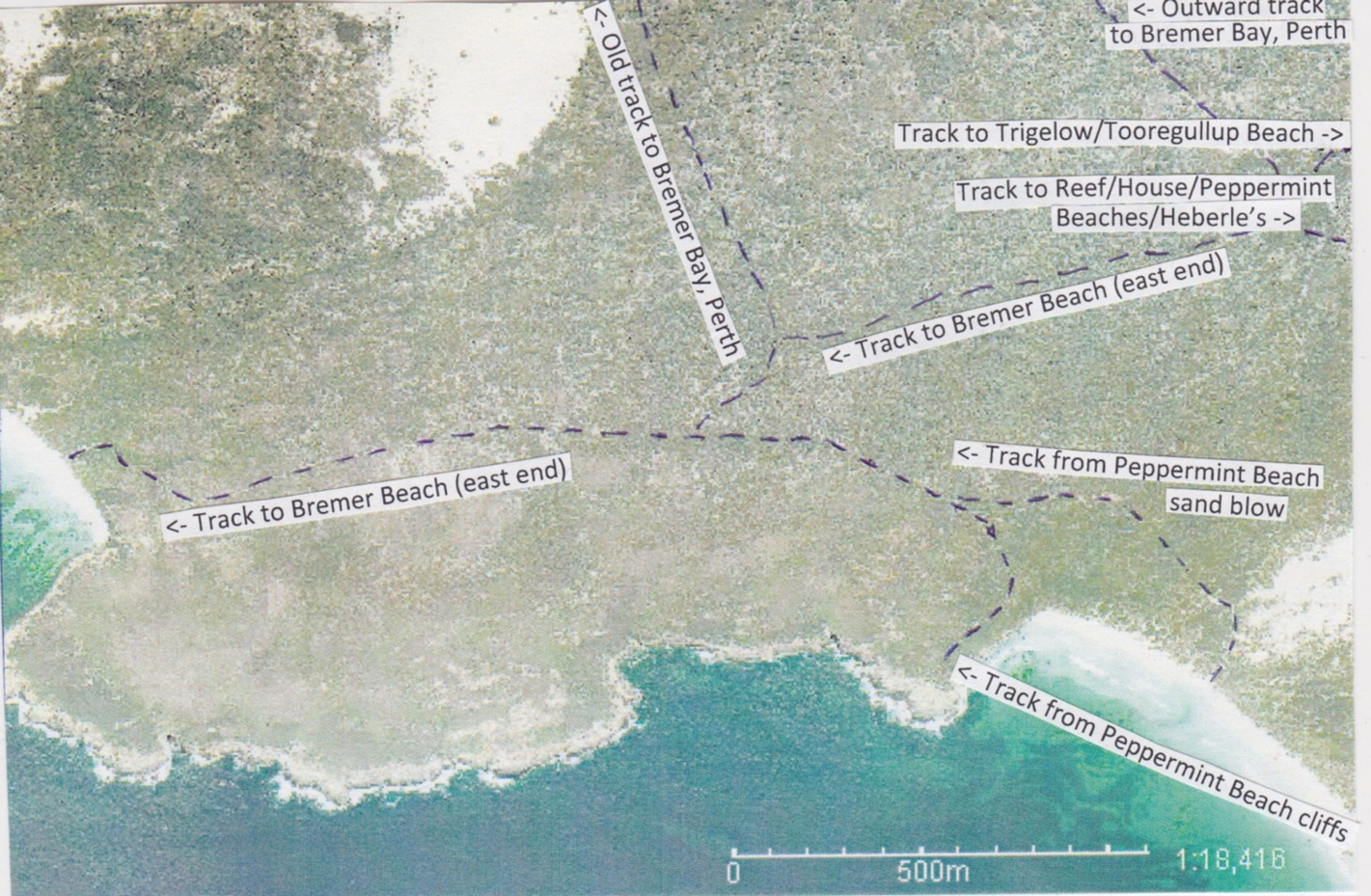
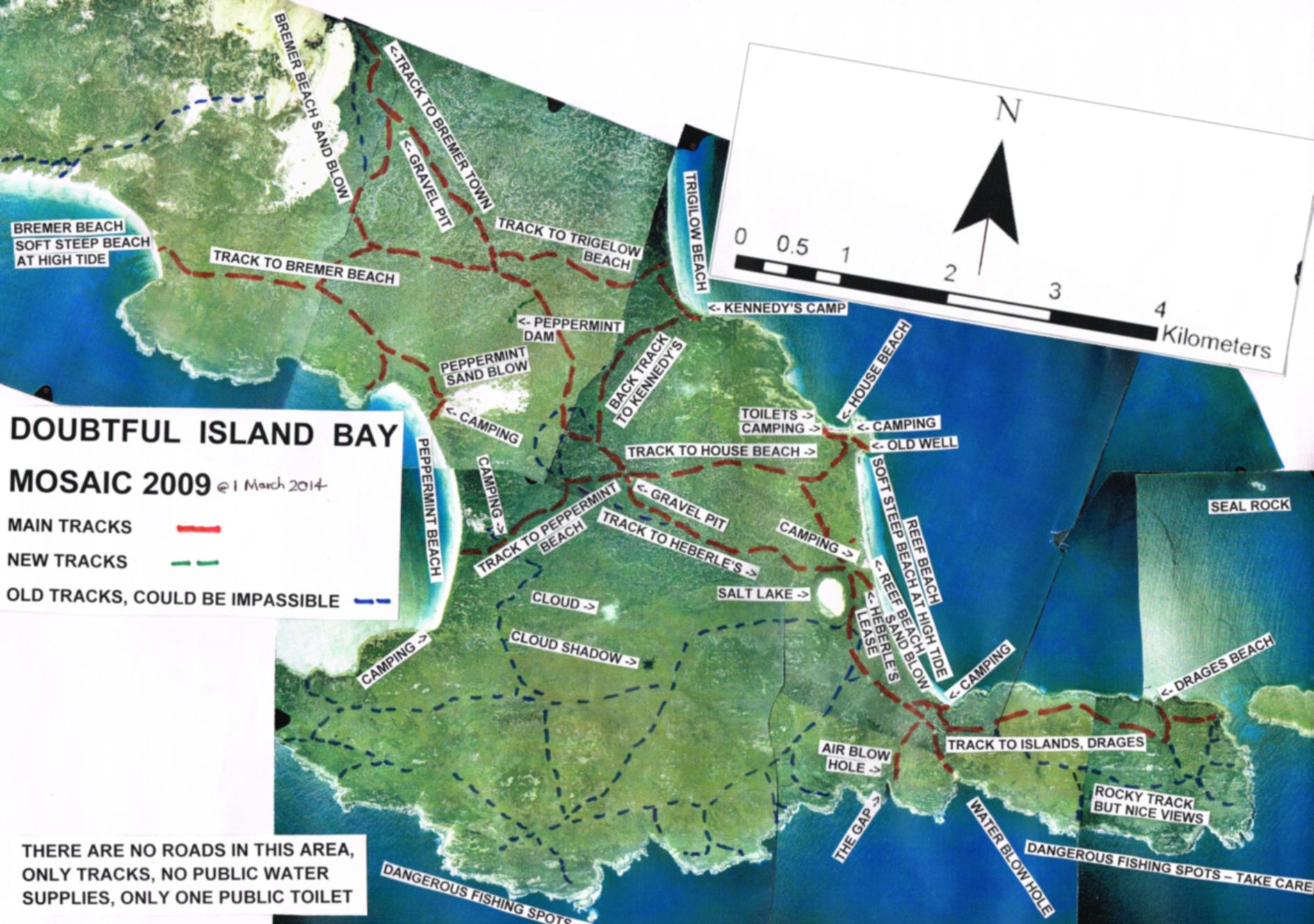
AIR PHOTO 8: MOSAIC SHOWING
TRACKS, TOURIST SPOTS, CAMPING - NEAR DOUBTFUL ISLAND BAY (2009
photography)
Below is an aerial photo mosaic showing tracks and areas
of interest.
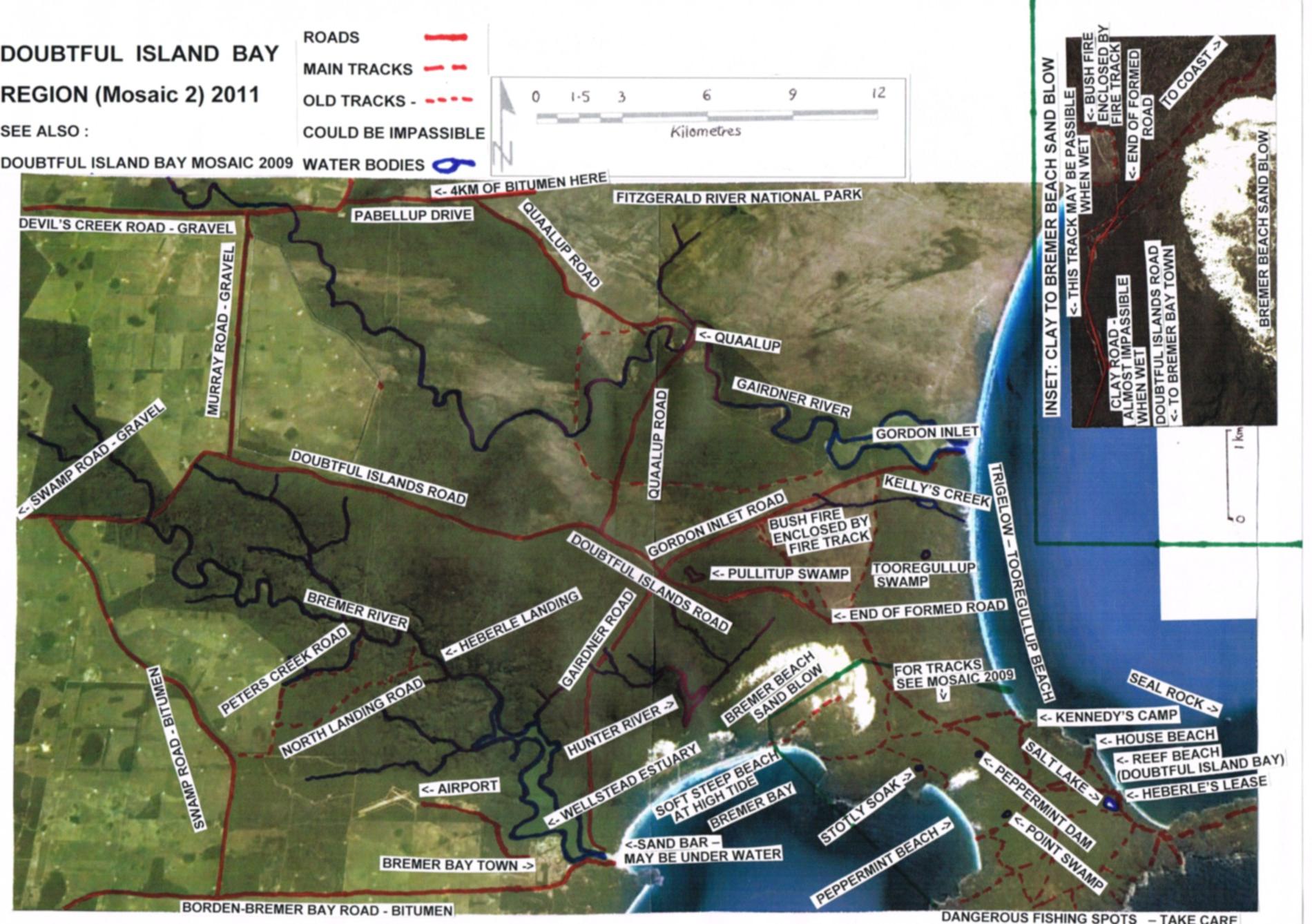
AIR PHOTO 9: MOSAIC OF
DOUBTFUL ISLAND BAY REGION, SHOWING ROADS, TRACKS, WATER BODIES (2011 photography)
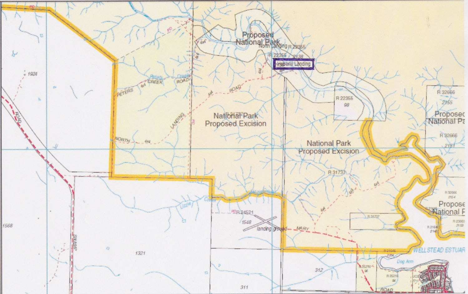
(2) LAND TENURE:
See MAP 4: below,
which is appendix 7 in Heberle (2006). Kent location 1307 of
405ha, adjoins House Beach and Reef Beaches. Kent location 1325
of 1095ha adjoins Tooregullup-Trigelow and Peppermint Beaches. Kent
Location 1306 (16ha) is within 1325, about 1km from Peppermint Beach.
There
are some squatters shacks and 2 small leases, one for Hassell's house at
House Beach and Ron Heberle fishermans lease on Reef Beach.
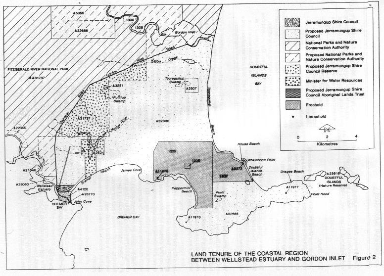
Kent Locations 1306 and 1325 were purchased in 1973 by
West Coast Waterfront Investments and thousands of undivided shares sold
to investors around the world. Kent Location 1307 was purchsed at about
the same time by Empell Pty Ltd and similarly, thousands of undivided shares
sold to investors. In August 2003, these locations were offered for auction.
an overseas investor purchased them, with the intention of subdividing
and selling them. However, the relevant local and State government approvals
have not been granted to date. Below are some of the auction papers.
(3) GEOLOGY, VEGETATION, SOILS:
See MAP 5: below,
which is appendix 8 in Heberle (2006).
(4) INDICATIVE CLIMATE DATA FOR BREMER BAY
| Jan | Feb | Mar | Apr | May | Jun | Jul | Aug | Sep | Oct | Nov | Dec | Annual | |
| Temp Mean Max degC | 26 | 25 | 24 | 22 | 19 | 17 | 16 | 16 | 18 | 20 | 22 | 24 | 21 |
| Temp Mean Min deg | 15 | 15 | 14 | 12 | 10 | 9 | 8 | 7 | 8 | 10 | 12 | 13 | 11 |
| Rain mm | 21 | 23 | 31 | 52 | 81 | 89 | 83 | 78 | 63 | 54 | 33 | 23 | 631 |
Suggestion. Unless you know the track very well, or are travelling in a convoy, with winches and/or tow ropes, avoid visiting Doubtful Island Bay during the wet months of May, June, July, August, when the clay track may be impassible on many days. Labor Day, Easter, Queens birthday, Christmas and New Year are usually OK.
(5) HISTORY:
Aborigines
Aborigines are believed to have lived in the south west
of WA for at least 38,000 years. At the time of white settlement the Goreng
(Koreng) tribe occupied the Gnowangerup-Bremer Bay area. The local population
was probably quite small (<120?) as the Aboriginal population of the
entire south west corner in 1829 is estimated as 6,000. (Berndt, 1973).
The language spoken was Noongar (Nyungar). According to the Doubtful Islands
area coastal plan, Colin Grey shepherded sheep for Hassell�s at Qualup
in 1947 and at Doubtful Island Bay in the 1950s.
Europeans
The first recorded ship to visit the area was the "Guiden
Seepaart" in 1627, captained by F Thijssen (Dutch) and carrying P Nuyts.
The first recorded British ships to visit the area were "Discovery" and
"Chatham" in 1791, captained by George Vancouver. He named Point
Hood and the Doubtful Islands. The first Frenchman was B D'Encrecasteaux
in 1792, who was in charge of two vessels "Recherche" and "Esperance".
Aboard one of these ships was a Mr. Riche after whom Cape Riche was named.
Matthew Flinders was in the area in January 1802 in the
ship "Investigator". He named Cape Knob, west of Dillon Bay, and proved
that the Doubtful Islands were islands by sailing between them. Flinders
also named West, Middle and East Mount Barren. Some say that he landed
at House Beach and dug a well to obtain water in "well corner" of Reef
Beach. This well was referred to as �Whalers well� by early settlers.
In July 1842 Edward Eyre (25) and Wylie passed through
the area on their journey from Adelaide to Albany. Other early visitors
were the botanist Drummond in 1843, Surveyor General J Roe in 1848 (he
named the Fitzgerald and Gordon Inlets) and the geologist Von Somner (who
examined coal deposits at Fitzgerald River) and the Gregorys in 1849.
In 1835, two youths (including Jimmy Newell) walked
from Esperance to Albany, a distance of 640 km. During the 1700s and 1800s
rabbits and goats were landed on islands in the Albany to Esperance area
to provide food for mariners.
Overland Telegraph Line
Construction of the overland telegraph line between
Albany and Adelaide commenced in Albany on 1st January 1875 and was completed
in less than 3 years. A telegraph station initially operated by Mary Wellstead
was established at Bremer Bay c1876. The line crossed the Gairdner River
near Quaalup and crossed Doubtful Island Road near the crossroads with
Gordon Inlet Road and Gairdner Road. Below is an air photo showing the
likely position of the telegraph line near Doubtful Island Bay. It would
only show on an air photo, if the track along it has been used in recent
years.
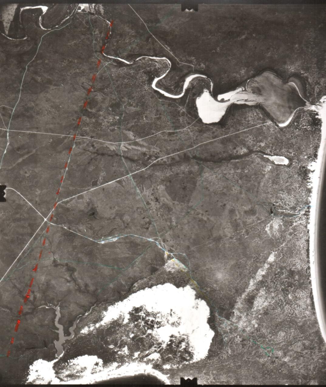
AIR PHOTO 10: Likely position
of Overland Telegraph Line (in Orange) near
Doubtful Island Bay.
Rabbit proof fence
As early as 1897 rabbits were reported crossing the South
Australian border into WA. To halt their progress the government commenced
constructing the No 1 Rabbit Proof Fence in 1902 from Starvation Bay near
Hopetoun, northwards. However by this time rabbits had already moved further
westwards, so contruction of a second fence (Rabbit Proof Fence No 2)
was commenced from Point Ann in c1904 and ran generally northwards.
However this failed to stop the rabbits, which by 1914 were reported at
Bremer Bay.
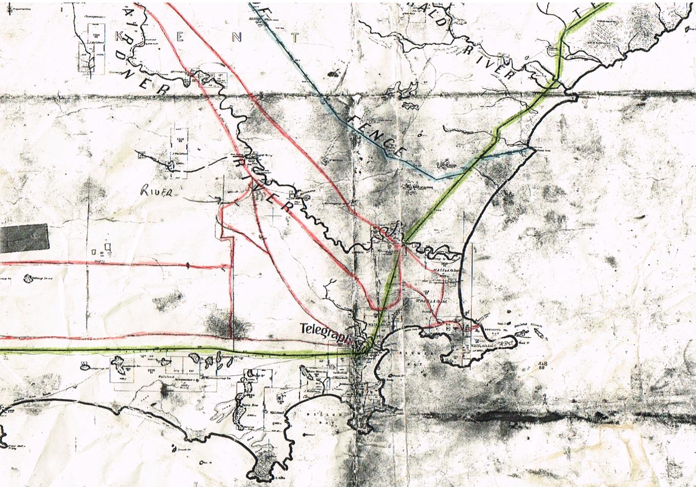
MAP 6: Map c1920s showing
Overland Telegraph Line (Green), No.2 Rabbit
Proof Fence (Blue) & Tracks used by Heberles
1936-c1961(Red)
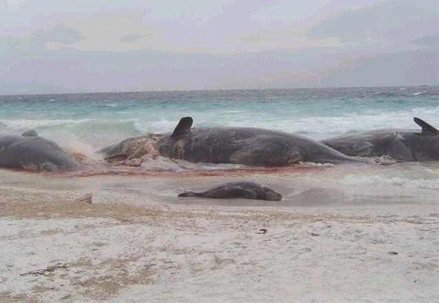
Whale strandings
There have been numerous whale strandings in the Doubtful
Island area. Strandings since the 1950s are listed in Mell (1988) as follows:
� September 1962 33 Physeter catadon
(Sperm whales) Reef Beach.
� May 1964 34 Pseudorca crassidens
(False killer whales) Reef Beach.
� October 1976 17 Physeter catadon
(Sperm whales) Trigelow.
� August 1979 13 Orcinus orca (Killer
whales).
� September 1979 22 Physeter catadon
(Sperm whales) near Gordon Inlet.
Other whale strandings since then include:
� July 2002 58 Pseudorca crassidens (False
killer whales) Trigelow.
� September 2003 9 Physeter catadon
(Sperm whales) Reef Beach.
Live strandings of whales almost exclusively occur where
lines of the earth's magnetic field cross the coast or are blocked by islands
and where whales typically use this magnetic field for navigation, as discussed
in Klinowska (1985). Certainly repeated strandings occur in some areas
and rarely elsewhere.
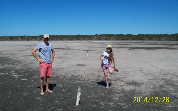
Stranded whales at Reef Beach 2003 (Susan Heberle)
(6) INDUSTRIES:
Whaling
French and American whalers operated in the area as early
as 1803. Whaling stations were established along the south coast in places
such as Doubtful Island Bay, Cheyne Beach and Cape Riche from 1836. The
first whaling station in West Australia, was at House Beach. Several whaling
teams operated at House Beach or nearby from 1836. Two whalers were killed
whilst whaling in 1878, one was buried near Whalers/Flinders well.
Data in Martin Gibbs (University of WA thesis, 1995) �Historical archaeology of shore based whaling in WA 1836-1879� (later updated, modified and published as a book) shows that Doubtful Island (House Beach) was the earliest whaling station in West Australia, in 1836. This was only 7 years after Perth was settled in 1829 (was Albany settled in 1826). Thus, Doubtful Island Bay was one of the first places settled in West Australia and yet, there still isn�t a good road into the place, 174 years after first settlement.
Gibbs shows that there have been 3 whaling stations at Doubtful Island Bay. The first was organised through a partnership between Thomas Sherratt an Albany merchant and William Lovett, a Hobart Captain. John McKail, resident of Albany, was manager. The same team operated in 1837. A second whaling team, organised by George Cheyne, Albany merchant, was based at House Beach in 1837, working in conjunction with the Master of the American whaler �Charles Wright�. Sherratt and Lovett complained to the Government but eventually entered into an agreement to sell whale oil to the American ship. Its uncertain whether whaling occurred in 1838. Gibbs considers that there was no whaling from House Beach 1839-1862. Whaling recommenced in 1863, under the direction of John McKenzie (son of Hugh), who also whaled at Torbay and possibly Cape Arid, that year. According to Gibbs book,published 2010, the final date for whaling from House Beach is uncertain, it may have been c1872. The information about whaling in the Heberle fishing book (page 12) was based mainly on Merle Bignell�s 1977 book about the history of the Gnowangerup Shire, which included Doubtful Island Bay at that time. It is incomplete and incorrect.
Whaling stations
Sherratt and Lovett�s whaling station was at House Beach,
at the eastern end, near to where Hassell�s shearing shed and wool shed
were located, years later. In 1836 John McKail was permitted to occupy
a small area at House Beach and in 1837 he was granted a whaling station
lease of 4.4ha at the eastern end of House Beach, 200m wide and 220m long,
with boundaries at right angles to House Beach, 100m each side of the summit
of Whalebone Point. These measurements don�t necessarily work out on the
ground. All access would have been by ship. House Beach and possibly the
South corner of Reef Beach are the only reliable anchorages for sailing
ships in this area. Cheyne�s whaling station, if at House Beach, would
have been outside of McKail�s lease, at the western end of House Beach.
Some flat rocks laid in the southern corner of Reef Beach, might have been
associated with whaling but could have been associated with sealing or
Hassell�s operations.
Further information is available from the link below.
Link
to notes on whaling at House Beach
Sealing
The first white men to stay more than a few days in the
area were sealers in the late 1700s or early 1800s. Sealers are believed
to have been in the area up until about 1850. Some of the whaling teams
also took seals.
Grazing
In 1860 John Wellstead settled in the Bremer Bay area,
firstly at "South West Bay" and later at "Peppermint Grove". He built Quaalup
homestead in 1858. In c1890, the Hassell�s took over Quaalup. Grazing
at Doubtful island Bay probably commenced c1873. John Hassell had 5
sons. In 1877 two of the sons AY and AW Hassell leased all of the properties
except Kojonup from their father. AY Hassell married in 1878. His wife
and family (4 sons and a daughter) sometimes stayed in a humpy at Doubtful
Island Bay. According to the Doubtful Islands Area Coastal Plan 1994, Captain
John Hassell settled in Jerramungup in 1849. Between 1849 and 1890 his
leases and holdings extended to Doubtful Island Bay.
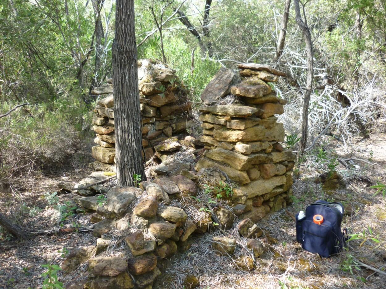
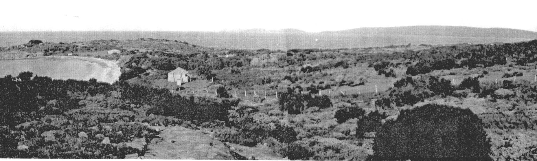
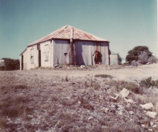
In 1895, surveyors defined Kent location 1306, some 500m from Peppermint Beach, an area of 16ha (400m x 400m), around a sheep camp, vegetable garden, water tank and possibly a well. An old chimney was also present, presumably the remains of an overseer or shepherds shack. It is referred to as an old chimney, it may have been there since c1873. This may have been Hassell's "Peppermints" settlement (which also may have been at House Beach), which was established by 1892 and had a store, hut and 2 acres cleared for vegetable growing. The garden was still in use in 1895, uncertain whether this was in location 1306 or at House Beach. Most of the shepherds would have been Aboriginals, but the shepherd in charge of each flock would have been white. Reliable water supplies are needed for for farm operations. At some stage, possibly in the c1873, a dam was established, shown as Peppermint Dam on some maps. See photo below. A track has recently been made in to this dam. The dam is some 300m NE of the NE corner of location 1306. The Harland family aggisted stock in this area in 1968-70. They camped close to the dam and put a fence around it. They also located the chimney and sheep dip. The larger locations (1307, 1325) were probably surveyed soon after (c1895). Fencing was installed c1895 onwards. Some fenceposts and wire are still present. The east-west fence across the salt lake, along the southern boundary of location 1307 (House Beach to Doubtful island Bay) is largely still in place, see photo below.
The Old chimney, Kent location 1306
East-west fence across the salt lake, along the southern
boundary of location 1307 (in 2014)
The main water supplies south/east of Gairdner & Gordon
Inlet Roads are:
� Peppermint Dam, almost 5km by track, from House Beach.
� Hunter River � Water Reserve /|\2524 288ha,
7km W of Peppermint Dam.
� Stotly Soak, 3km W of Peppermint Dam, near track to
east end of Bremer Beach.
� Tooregullup Swamp � Water Reserve /|\2507
81ha, 5km N of Peppermint Dam.
� Kellys Creek, 1.5km N of Tooregullup Swamp.
� Pullitup Swamp � Resting Place for Travellers &
Stock /|\3251 40ha, 8km NW of Peppermint Dam, 1.5km E of crossroads
of Gairdner & Gordon Inlet Roads.
� Point Swamp, 4km SE of Peppermint Dam.
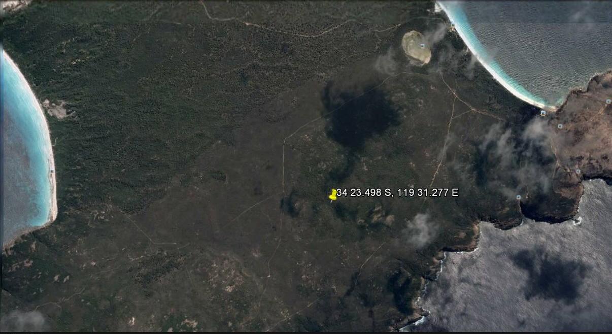
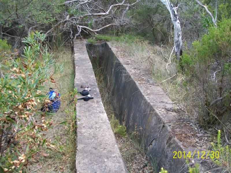
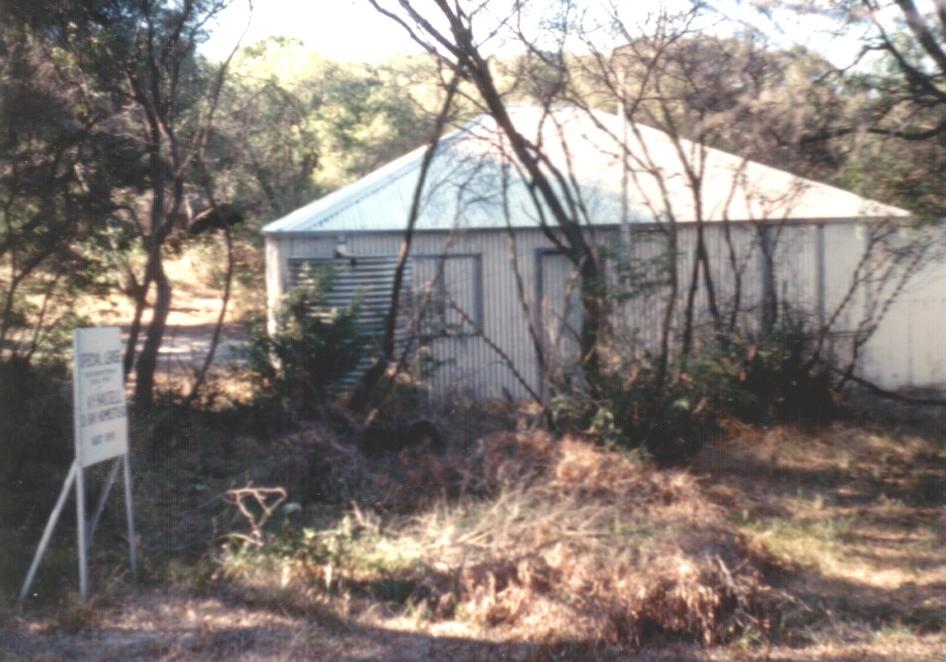
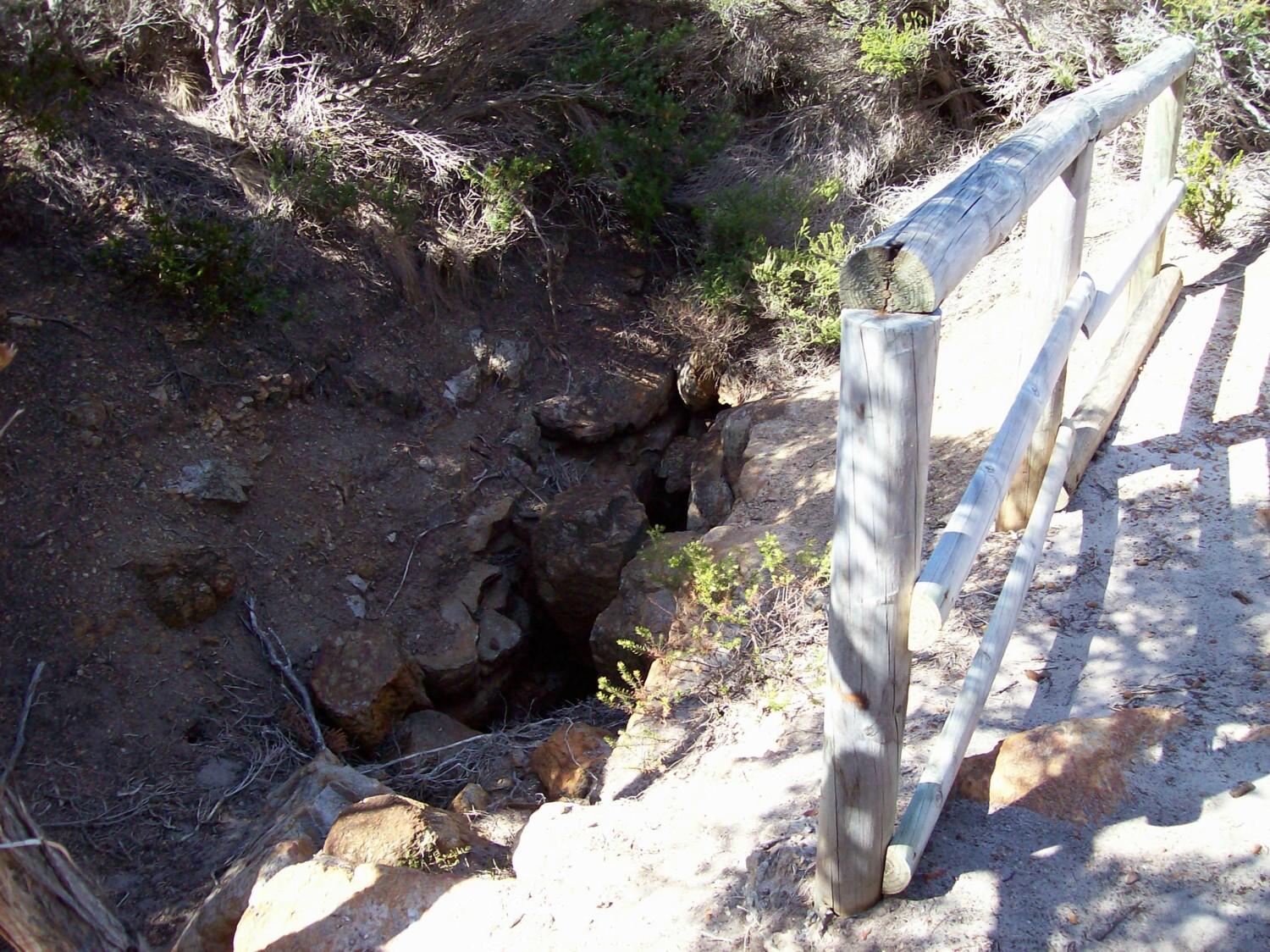
The Doubtful History website refers to (Hassell's) sheep dip at 34 23.498 S latitude 119 31.277 E longitude, which is about 1.7km SSW of the salt lake. See image below. This sheep dip, which is a concrete enclosure, may have been built in c1894. There was a similar sheep dip at the Jerramungup farm, where sheep from Doubtful Island Bay may have been dipped, as they passed through Jarramongup after shearing . This sheep dip has been relocated and a walk trail to it has been marked with pink flagging tape. At a later date the route in will be signposted, for 550m from the track junction on the bottom (western) track, see photo below. From the track junction walk 50m south along the track going south. Then follow the very old track (marked with pink tape) at right angles to the main track, heading east for about 250m, then follow the pink flagging tape east through very dense bush for another 250m to the sheep dip, which is on the northern bank of a seasonal stream. A pipe used to run water into the sheep dip, from the stream but the pipe has filled up with silt and sand. A photo of the sheep dip is below the satellite image.
AIR PHOTO 11: Location
of Sheep Dip
Hassell's Doubtful Island Bay Sheep Dip 2014.
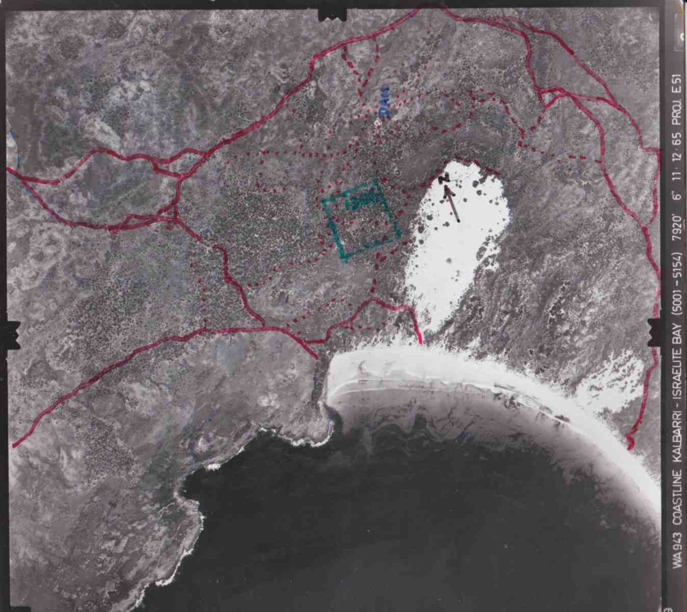
From c1873 numerous tracks were made near location
1306 and Peppermint Dam, as shown by red dashes on the 1965 AIR
PHOTO 12 : below. Location 1306 is bordered in green.
By 1965 many of the oldest tracks would have disappeared; 95% + had
disappeared by 2009 and most open areas in 1965 are now densely vegetated.
It is likely that the farm head quarters was moved
from inside location 1306 (to be) c1893. Shepherds then camped at House
Beach, known at that time as Whalers camp. By 1894 the Hassell estate had
been divided between the brothers and it was no longer possible for the
Jerramungup sheep to be shorn at Kendenup. In 1894 AY Hassell had built
a shearing shed and living quarters at House Beach so that wool
could be shipped from there to Albany. The original house/humpy at House
Beach was built in c1893. It and/or the 2nd house was shifted from Albany
and transported on the "Grace Darling". It was replaced in c1900, by the
house shown on the 1913 photo below, which burnt down in 1980. Extensive
living quarters would have been needed, for 30 shearers and possibly 20
farm workers at times. Tents could have been used for seasonal workers.
Many of the farm workers were Aboriginals (who would have had their
own camp) and some Chinese were employed, notably for fencing.
Ednie Hassell (one of AY Hassell's sons) was the last
Hassell to operate the Jerramungup - Doubtful Island Bay property. In 1927,
Ednie Hassell blew off his right hand dynamiting for salmon at House Beach.
In
1928 a private telephone line was run from Jarramongup to House Beach.
By 1946, due to family differences, both of his sons had left the property.
In 1948 the government commenced negotiations to purchase the Jerramungup
- Quaalup - Doubtful Island property for inclusion in the War Service Land
Settlement Scheme. The deal was completed after Ednie Hassell's death
in 1950 and Jerramungup town established there in 1953. Stock were rounded
up but some were missed and occasionally sheep and cattle were sighted
until about 1970. Some stock from local farmers (the Harlands) were aggisted
in the area during drought in the 1968-1970 period.
House Beach 1913, from south end, showing shearing
shed and wool shed, from Cyclopedia of W.A.
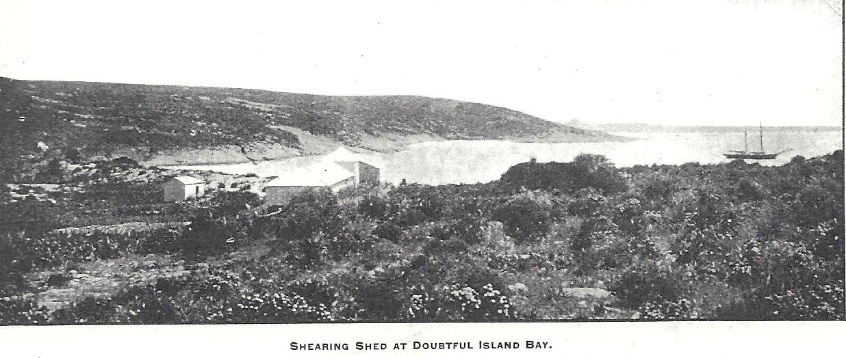
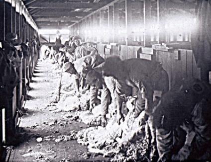
Top/left photo: House Beach 1913, from south end, showing shearing shed and wool shed, from Cyclopedia of W.A. Below photo of shearing (from Doubtful History website). There would have been some huts, tents and camping shelters near the the wool shed. According to the Shire of Jerramungup Municipal Heritage Inventory (undated), up until 1916, all shearing from the Jerramungup-Quaalup-Doubtful Island Bay operation was done at the above shearing shed, where 30 shearers worked seasonally. From 1916 all shearing was done at Jerramungup. The House Beach shearing shed was built 1894and completely pulled down by 1924. It is possible that there was an earlier, smaller shearing shed at this location. Its likely that all shearing was done at House Beach from 1894, with sheep droved there from Jerramungup, Quaalup and about 10 nearby farms. Quaalup had its own shearing shed in use from c1890 to probably 1893. Perusal of Hassell's Jerramungup diaries and Cleve Hassell's 1974 book "The Hassells of Albany"suggests that only about 1400 sheep were typically at Doubtful Island Bay in the 1870s-1890s. Diary records suggest that there were typically >2000 sheep at the coast in the 1900s.
Shearing at House Beach, Doubtful Island Bay, from
Doubtful History webpage.
House Beach 1913, from north end, showing house.
House Beach c1920s from Doubtful History website.
House Beach c1960s from Doubtful History website.
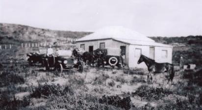
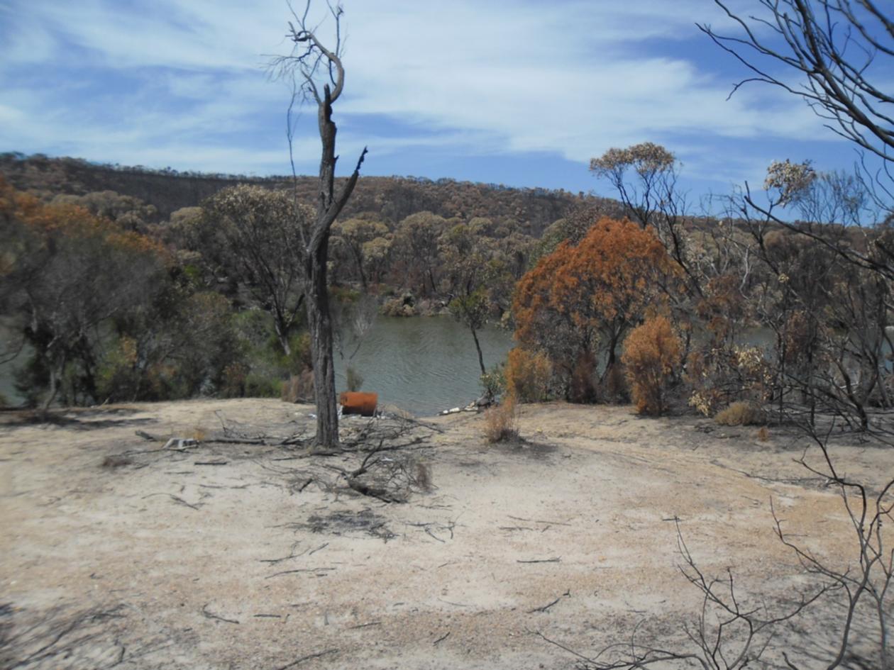
Peppermint Dam 2013 (Photo from Ron & Susan
Heberle). Possibly established c1873. Its now shallow and dries
out some summers.

Kellys Creek on Trigelow Beach
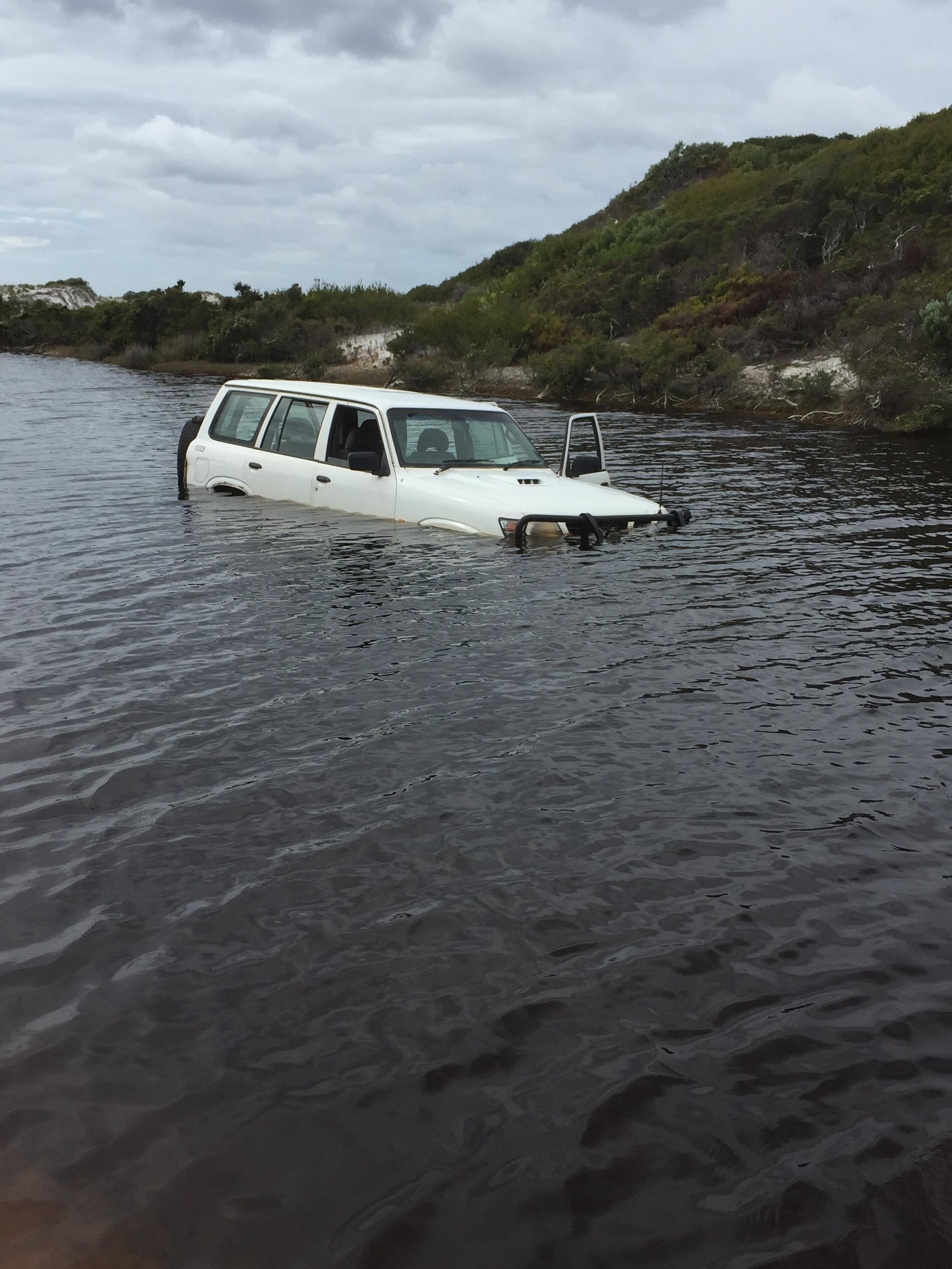
Nissan in creek September 2017 (photo from Susan heberle)
Hassells House at House Beach was destroyed in a fire
in 1980. It was rebuilt in 1983, on a new location further east by relatives
of Hassells, including the Balls.
Left: Hassell's house at House Beach 1970, burnt down
1980. Right: The new Hassell's house at House Beach. Same floor plan
as the original.
 |
 |
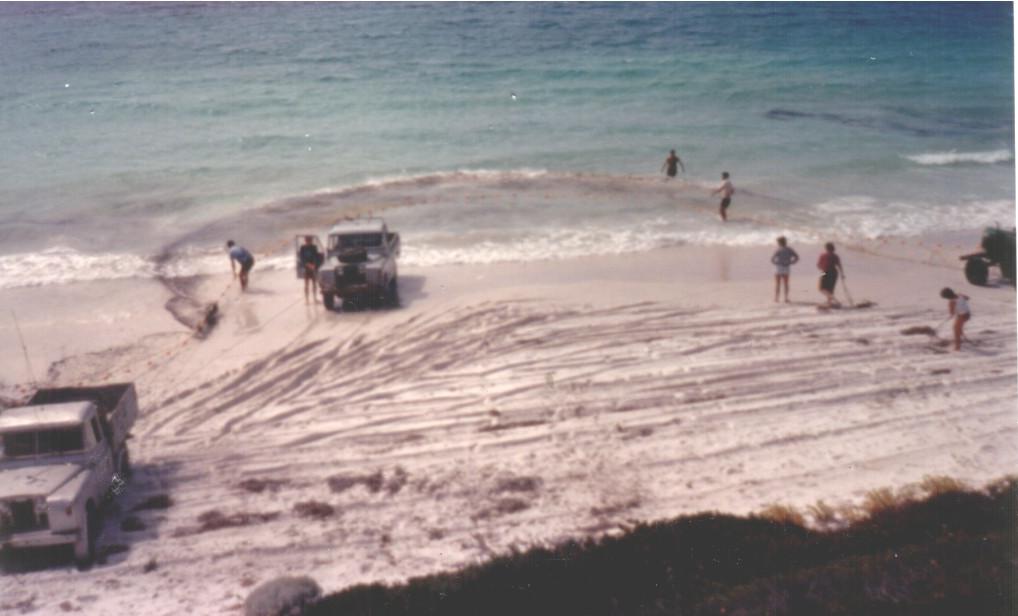
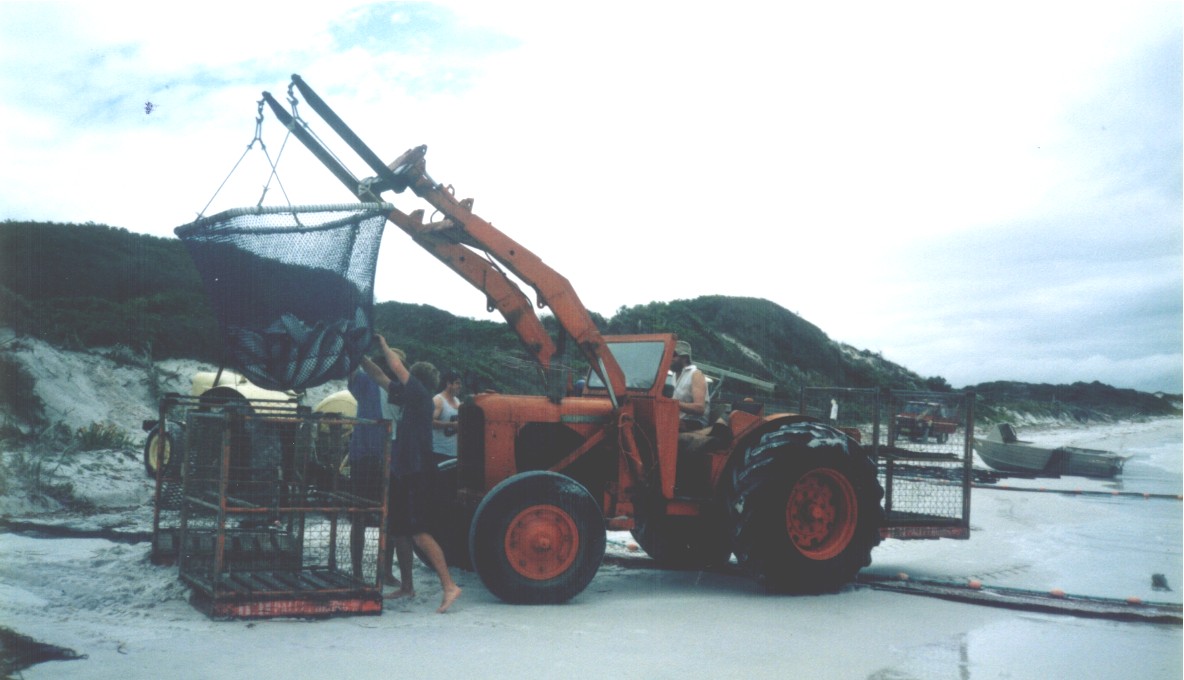
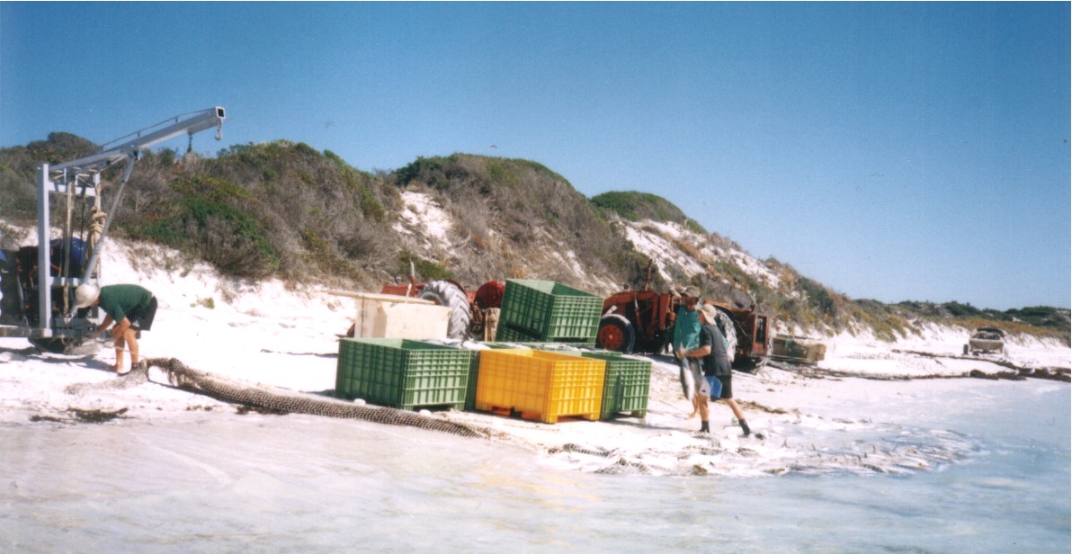
Professional fishing
Salmon, herring, shark
The Heberle family fished commercially for herring and
salmon 1946-2004 in this area. They also fished for shark and various table
fish species 1946-1963. Bentley fished for salmon and herring at Tooregullup-Trigelow
1960-1997.
Cullinane fished for salmon at Trigelow 1953-1954, Reef
Beach 1955-1963. The Kennedys fished for herring and/or salmon 1982 onwards
(House Beach and Drages Beach) and moved to Trigelow in 1998.
Below are some photos of Heberle fishing operations.
 |
 |
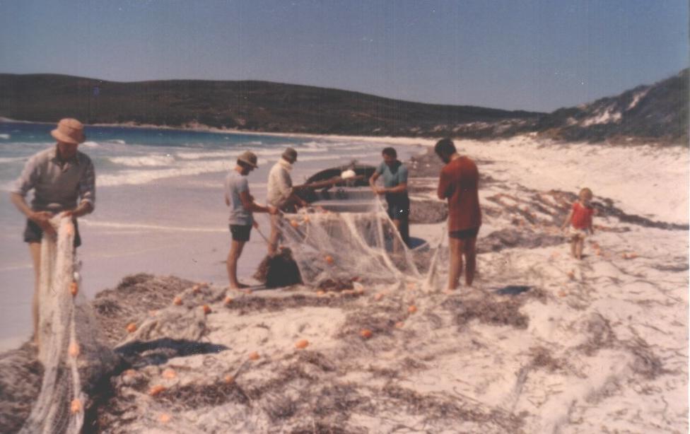 |
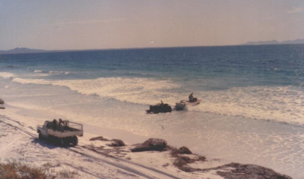
| Launching jet boat (with salmon net) | Pulling in salmon net | Mending and loading salmon net |
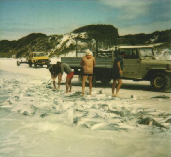 |
 |
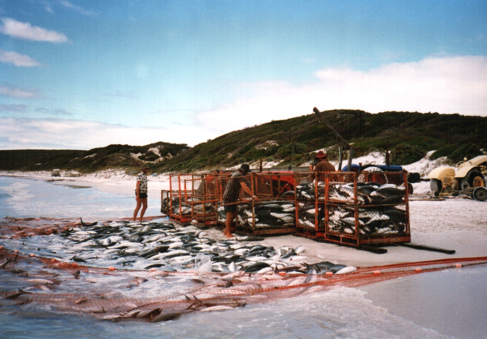 |
| Loading salmon | Loading salmon in to chep pallets by tractor | Loading salmon in to chep pallets by hand |
 |
 |
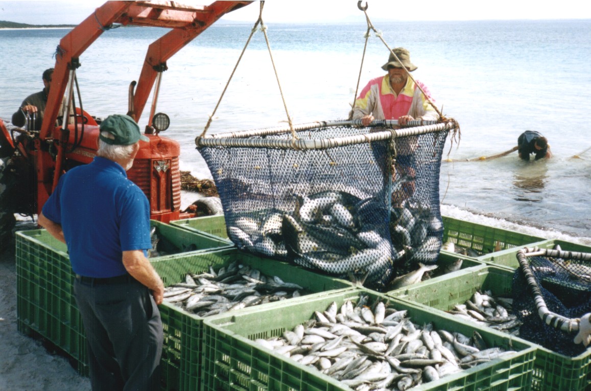 |
| Loading salmon in to plastic bins | Pulling in herring net | Loading salmon and herring from herring net |
Heberle River Fishing
The Heberle family fished professionally in all the estuaries
near Doubtful Island Bay, when and where permitted, 1936-63. This included
the Bremer River, notably at "Heberle Landing", some 7km from Bremer Bay
town.
 |
 |
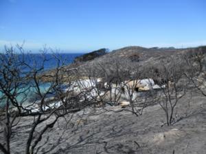
| MAP 7 : Heberle Landing is c7km NNW of Bremer Bay townsite. | Heberle Landing, a fishing camp and boat launching area, on the Bremer River. This area was burnt in 2012. |
Abalone
Abalone fishermen have operated in this area since the
1970s, or earlier.
Squid
Professional Squid fishing has occurred since the 1990s,
or earlier.
Pilchard, "mulies"
Pilchard fishing has occurred in the area since the 1990s,
or earlier.
Tourism (excluding Fitzgerald National Park)
Due to the very poor access and negligible signage, Doubtful
Island Bay is probably only visited by a 1000 or so tourists each year
(20+ per week), many of them during long weekends and school holidays.
If good road access was established for 2 wheel drive vehicles, this could
increase 10+ fold.
Locations of interest to tourists would include the following:
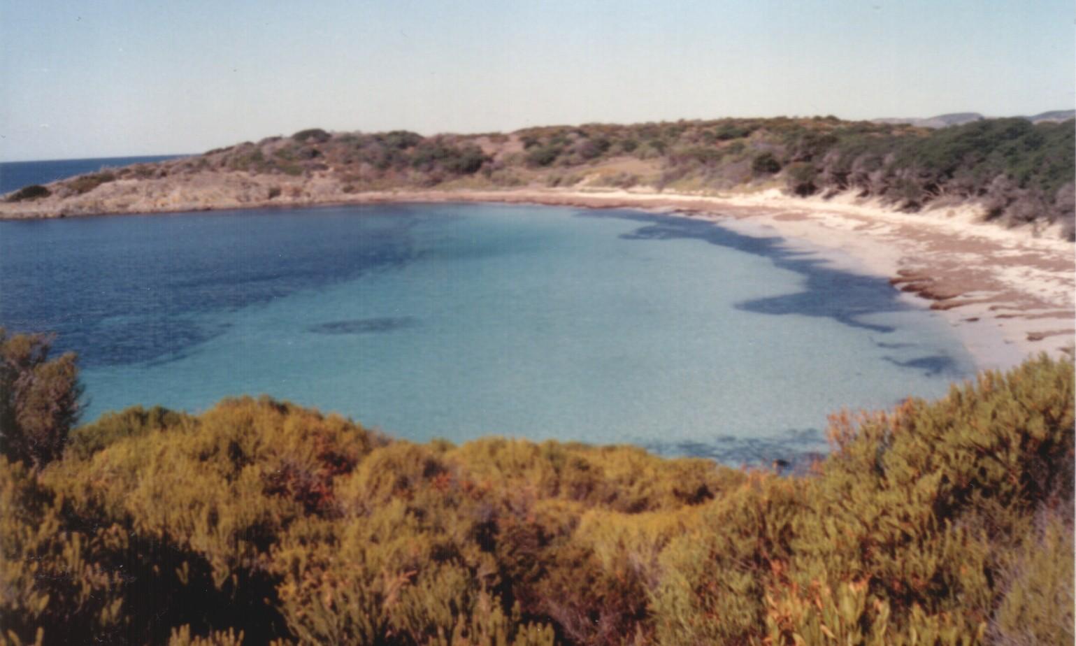
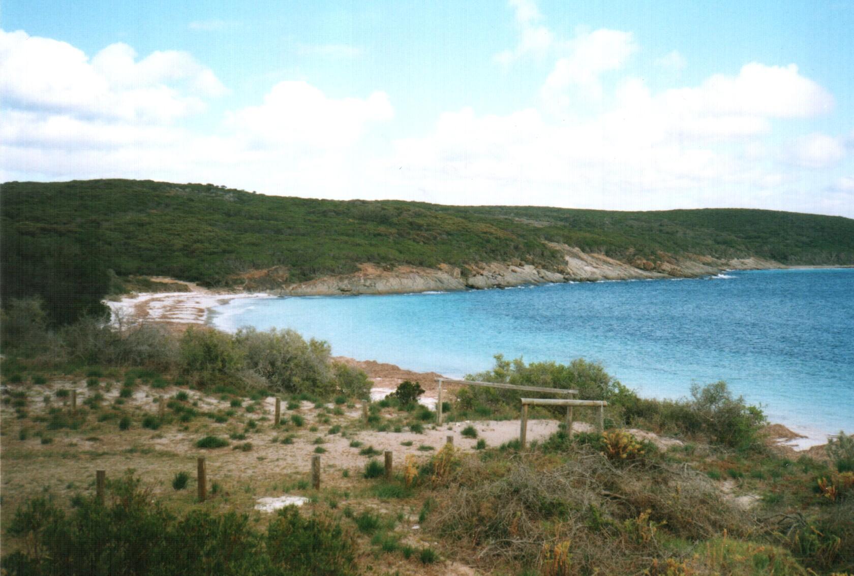
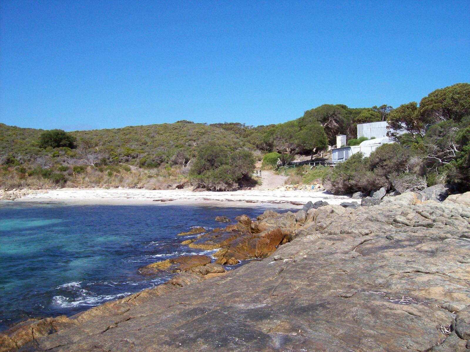
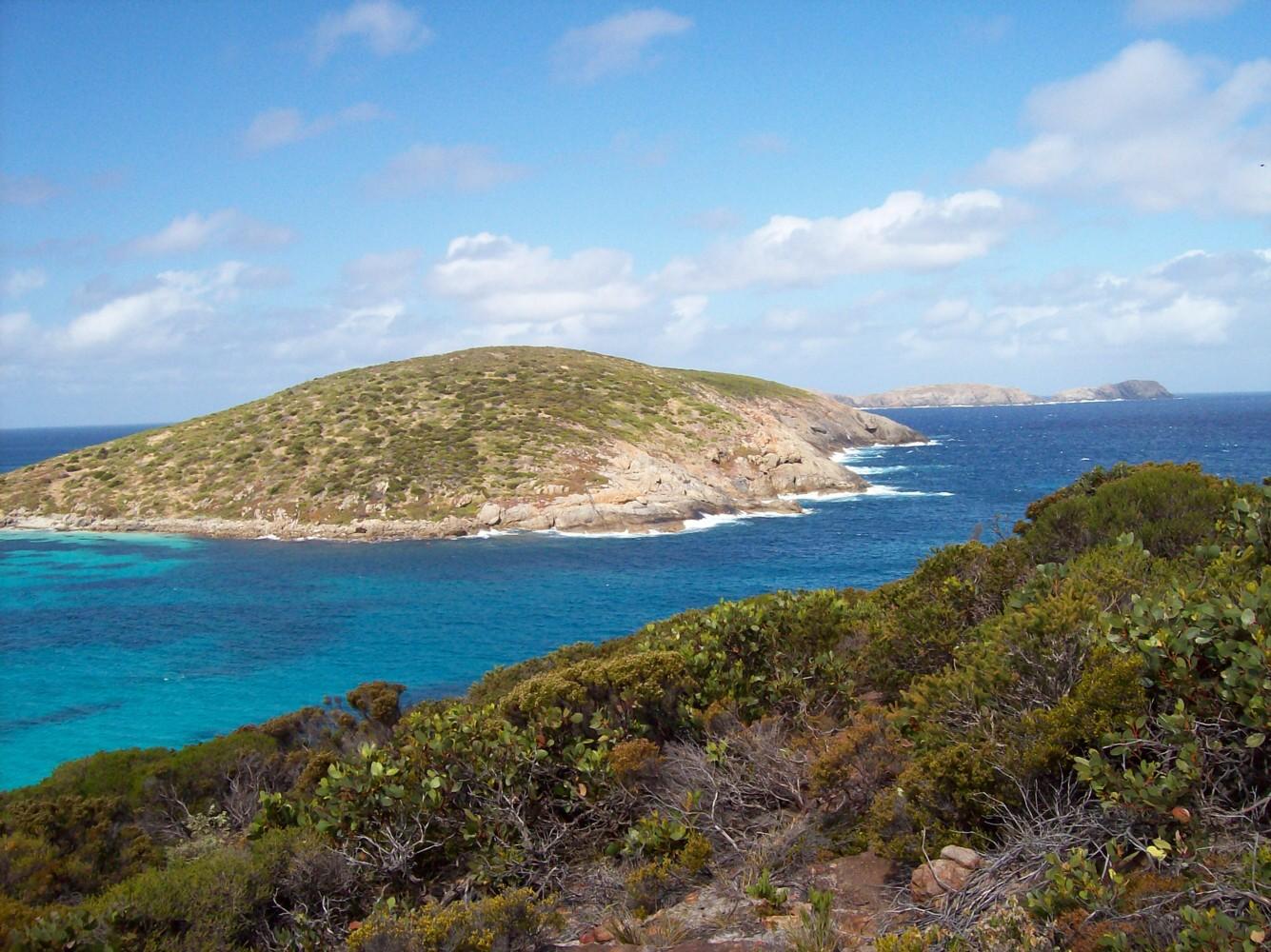
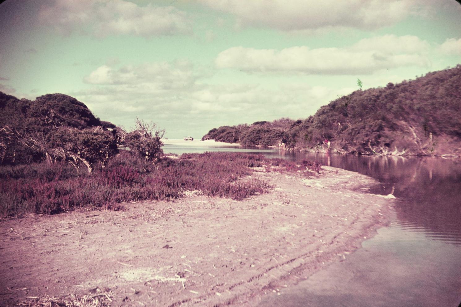
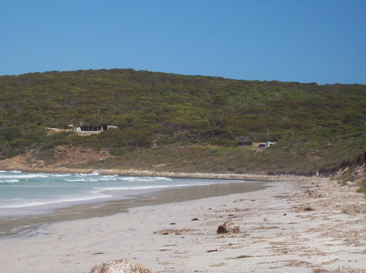
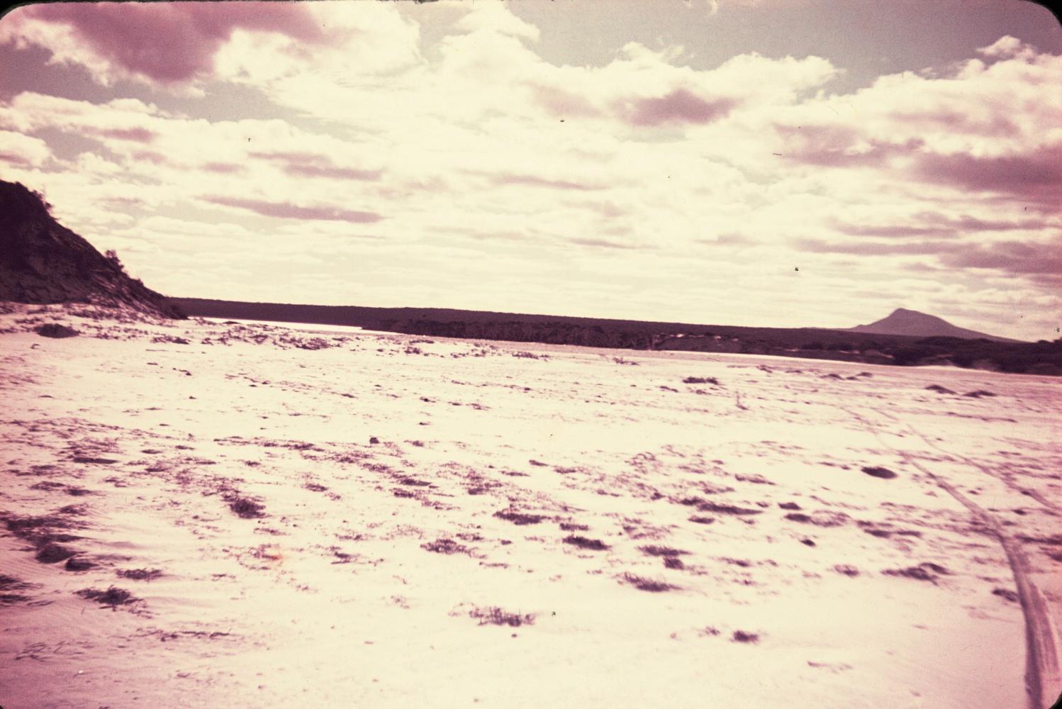
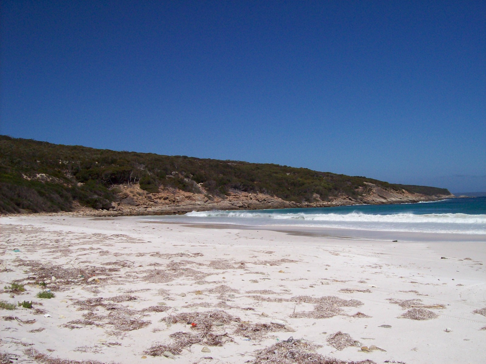
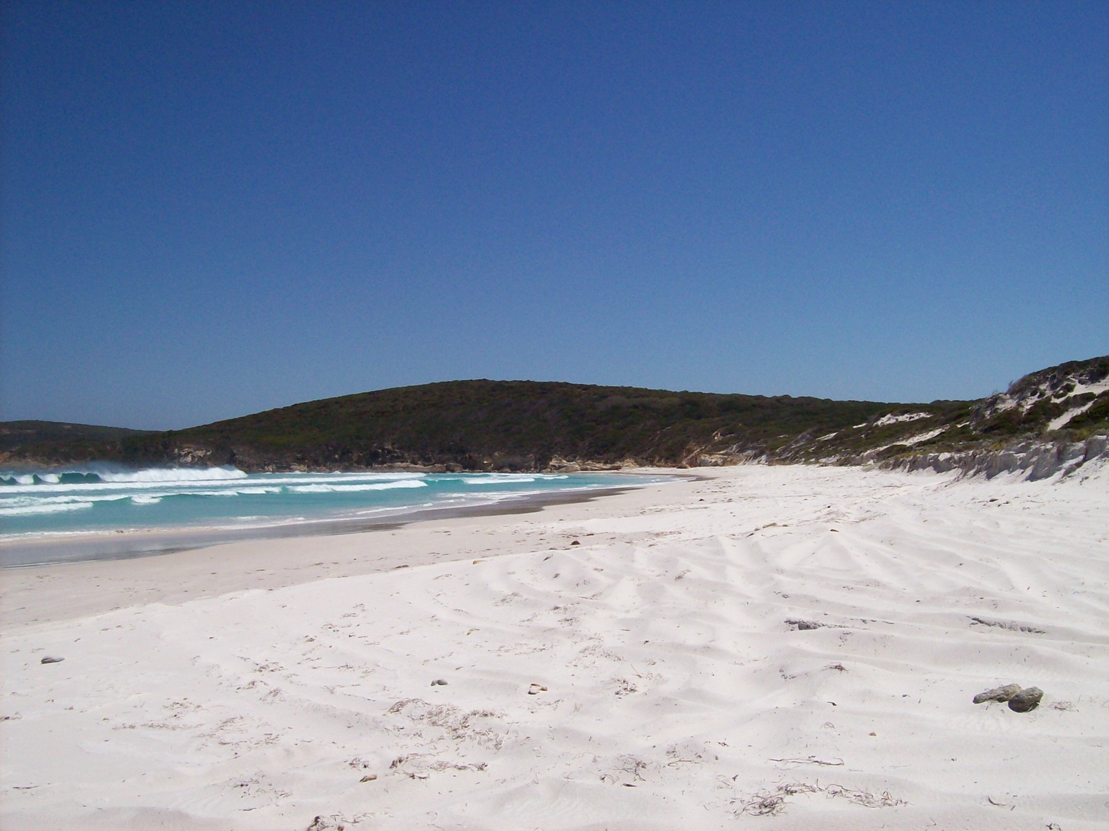
- Beaches: Tooregallup-Trigelow Beach, House Beach, Reef Beach (Some call this Heberle Beach, others call it Whalebone Beach), Drages Beach, Peppermint Beach (actually part of Bremer Bay but usually accessed from Doubtful Island tracks).
- The Doubtful Islands.and Seal Rock.
- Heberle fishing camp and lookout.
- Fishing camp in the south corner of Tooregallup Beach.
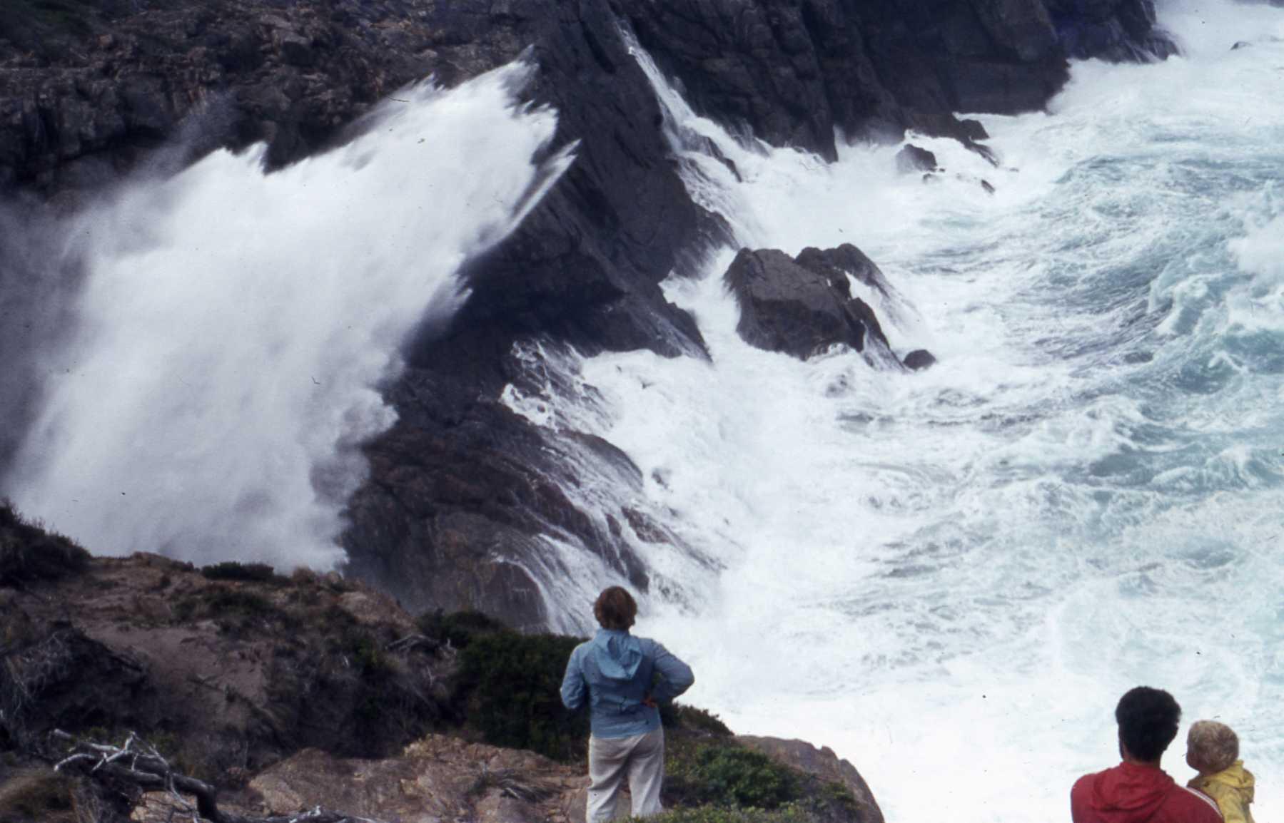
- Water blowholes, Air blowholes.
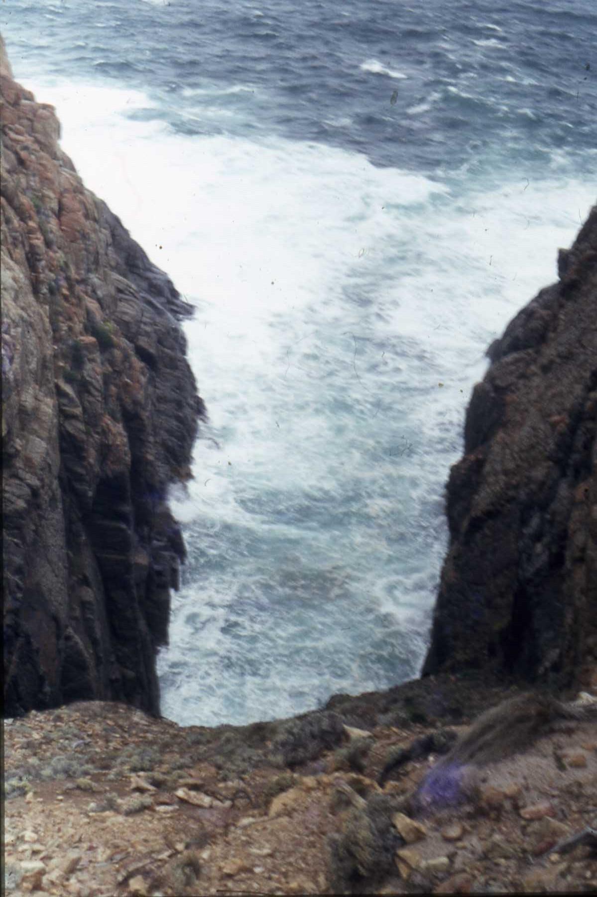
- Gap, south coast cliffs.
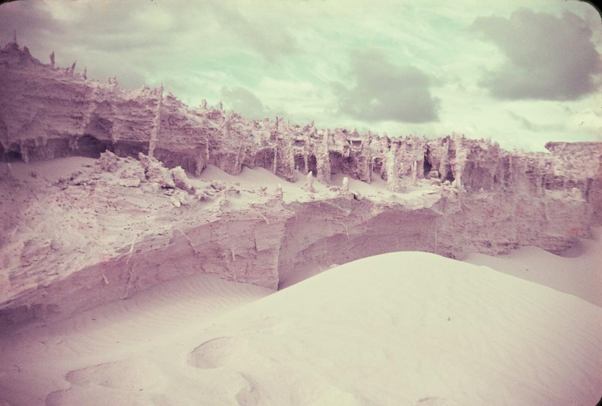
- Peppermint and Bremer sand blows, limestone formations.
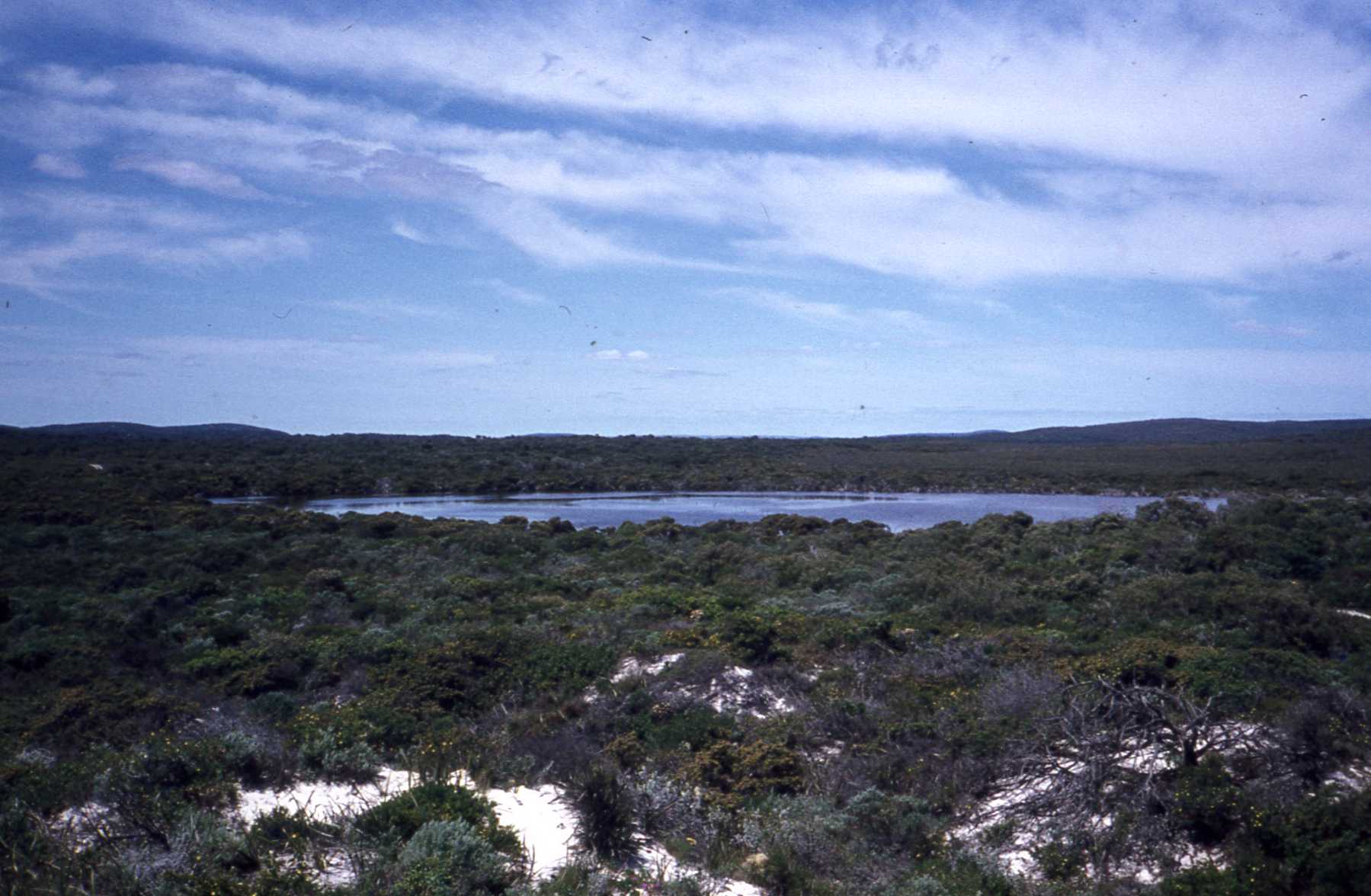
- Salt Lake.
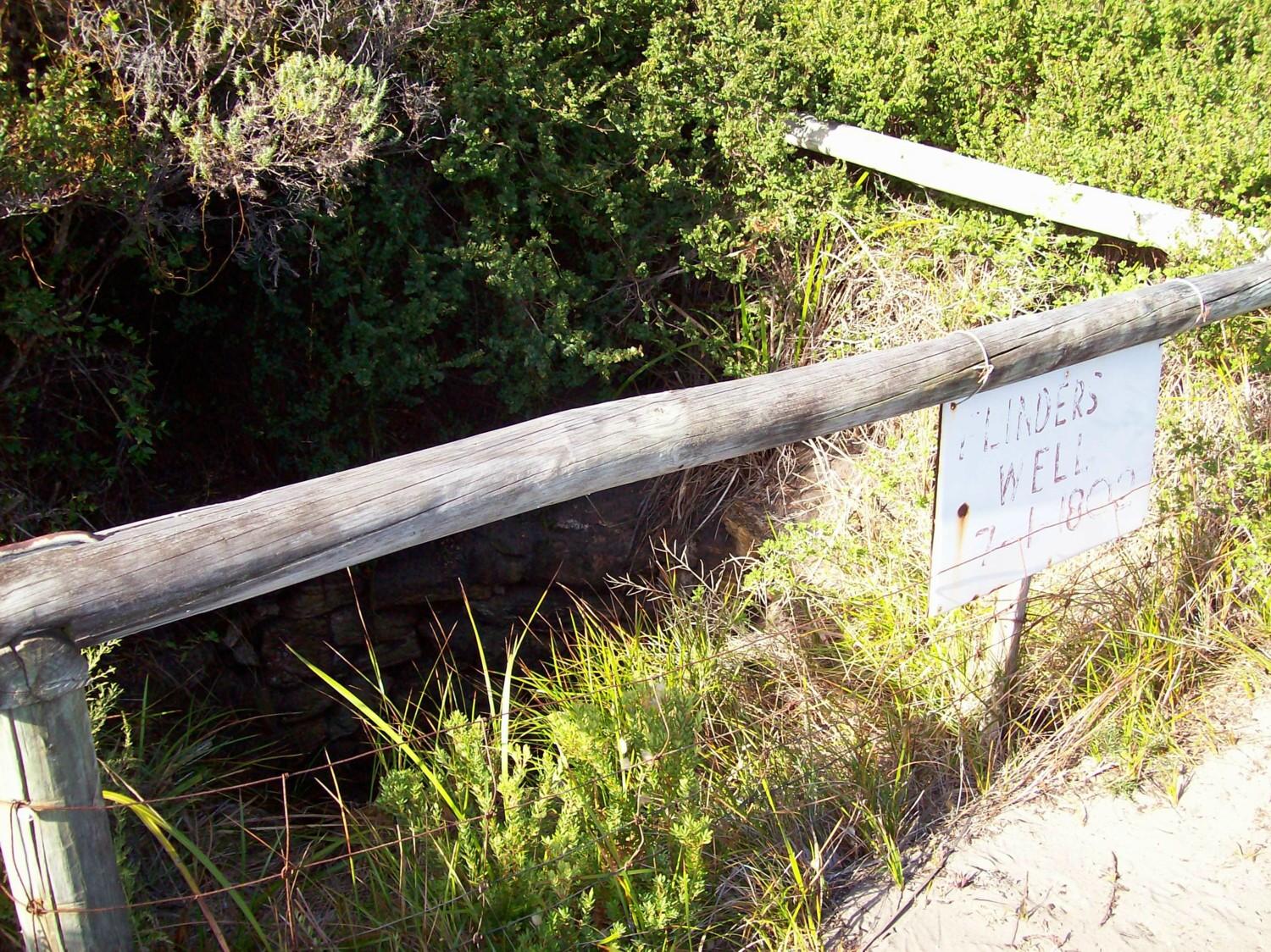
- Flinders/Whalers well near House Beach, north end of Reef Beach.
- Rivers: Gairdner River, Gairdner River - Gordon Inlet, Kellys Creek.
- Fishing, swimming, surfing (Peppermint Beach is best), camping.
- Whales (in season, July - October), Dolphins, Salmon (in season, late February to early April).
- Wildflowers (in season).
Air blowhole S 34 23.481 E 119 32.435
Alan John Gray monument S 34 21.965 E 119 31.707
Gap S 34 23.465 E 119 32.436
Heberle fishing camp, Reef Beach S 34 22.614 E 119 32.043
Kennedy fishing camp, Trigelow Beach S 34 21.595 E 119 30.483
Old chimney near Peppermint dam S34 22.169 E119 29.106
Peppermint dam S 34 21.919 E 119 29.415
Peppermint Beach limestone formations S 34 22.403 E 119 29.420
Peppermint Beach south runway S 34 23.202 E 119 29.542
Sheep dip S 34 23.498 E 119 31.277
Water blowhole S 34 23.369 E 119 32.807
Whalers well S 34 21.944 E 119 31.696
Old chimney and Sheep dip coordinates provided by Ron Harland. Others by Garmin eTrex10.
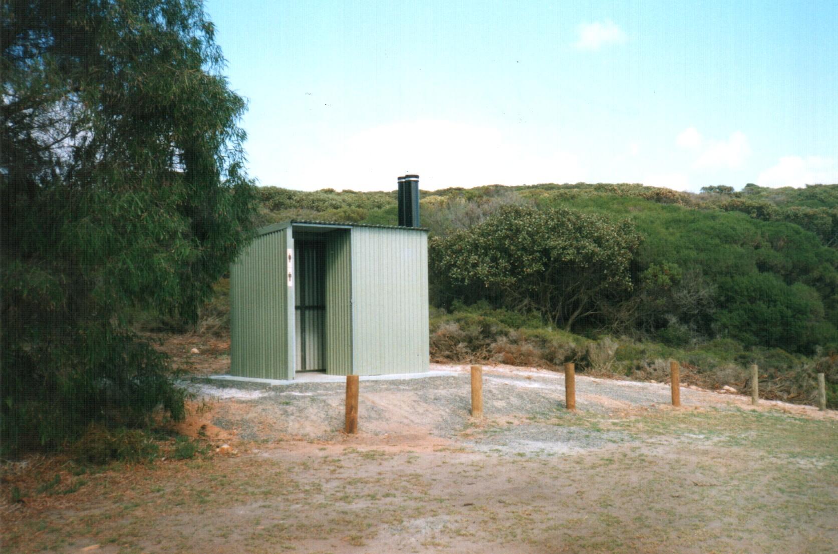
Camping areas. Some are shown on Maps 2A 2B, & 2C and include House Beach west end (where there are toilets) and east end; Heberle fishing camp, sand blow N of Heberle fishing camp, south corner of Reef Beach, north corner of Reef Beach, south corner of Tooregallup-Trigelow Beach, Gairdner Inlet, Drages Beach, Peppermint Beach sandblow and east end of Peppermint Beach.
Quaalup wilderness retreat is near the Gairdner River
and Fitzgerald National Park.
Link
to Quaalup wilderness retreat website.
Below are photos of these areas.
 |
 |
 |
| The Gap | Water blow hole | Air blow hole |
 |
 |
 |
| House Beach from north end | Toilet at House Beach | House Beach from south end |
 |
 |
 |
| Flinders/whalers well | Drages Beach | Islands, south coast cliffs (Graham Bowden) |
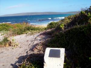 |
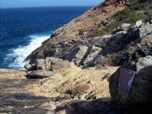 |
 |
| Monument in well corner to child of Colin Gray | Monument at water blowhole to Fred Atkins 1914-1985. Photo taken 2012. Unfortunately people prized this plaque off the rock in 2013. | Drages Beach December 2012, after the bushfire. Drages house, tractor and jetboat all destroyed. |
 |
 |
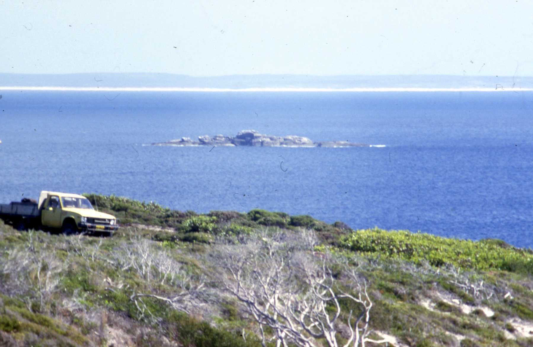 |
| Islands | Salt lake behind Heberles camp on Reef Beach, with water. | Seal rock |
 |
 |
 |
| Kelly's Creek (Graham Bowden) | Tooregullup-Trigelow Beach south end | Gairdner River sand bar (Graham Bowden) |
 |
 |
 |
| View from lookout at Heberle's fishing camp on Reef Beach | Peppermint Beach south end | Peppermint Beach north end |
 |
 |
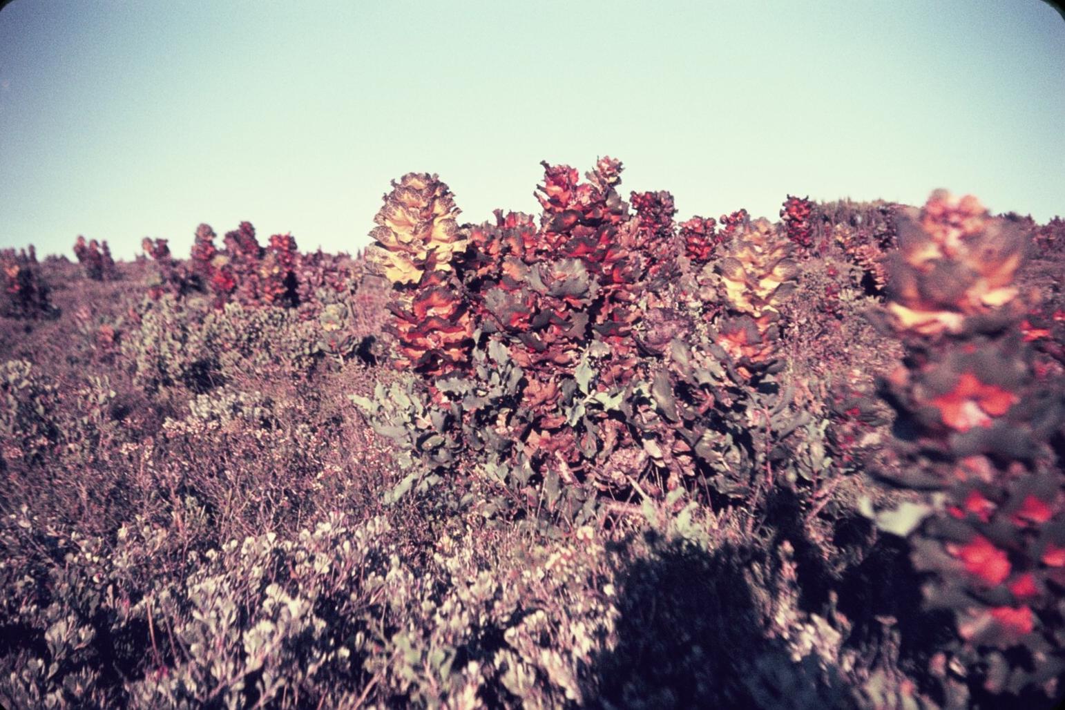 |
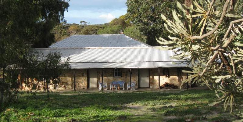
| Peppermint Beach limestone formations (Graham Bowden) | Quaalup homestead. (from their website) | Royal Hakea (Graham Bowden) |
James� daughter, May McGlade, died in 1927 at the age of 18 years from a chest complaint. On return from shepherding sheep (2 days later) James took a tall kitchen cupboard out
of the Homestead, knocked the shelves out and that became Mary�s coffin. Mary was buried on the side of the track leading to Quaalup (the lonely grave on the nature walk).
Mick Hassel married in 1930 and the Homestead was extended by three rooms. The Hassel family deserted Quaalup and the House Beach area, once a main road was build from
Jerramungup to Albany. The shearing shed at House Beach and James McGlade´s cottage were pulled down and the materials utilized to extend the main shearing shed at Jerramungup.
The Lugge family was next to live at Quaalup after swapping land they owned with the government. However, because of health problems they soon returned to Perth. Quaalup then
became part of the War Service Settlement Scheme made up of 13 blocks. Unfortunately, due to the land not being viable to grow food crops on, it was never taken up. Quaalup was
eventually sold off block by block. Two of those blocks have gone to the National Park and the remaining are owned by 6 different owners. Geoff and Norma Keen bought Quaalup Homestead in 1974.He was the Park Ranger at that time and the family spent years restoring the Homestead, which was badly vandalised. The old barn was a solid building up to the seventies, when somebody stole the roof and it started to fall apart. In 1989 the O�Brien family purchased Quaalup. They furnished the Homestead as a museum and offered meals in the dining room. Since June 2004 it is owned by Karin and Carsten from Hamburg, Germany.The 40 acres of native bush surrounded by the Fitzgerald River National Park are now the
Quaalup Homestead Wilderness Retreat with the Homestead being part of it, giving guests and visitors an impression of the early settlement days.
The Fitzgerald River National Park covers an area
of over 329 000 ha, it is one the largest and most botanically significant
National Parks in Australia. Within the park are found nearly 20 per cent
of Western Australia�s flora species, many of which occur only within the
National Park. The Park provides some spectacular recreational opportunities
within its varied landscapes including bushwalking, 4-wheel driving, camping,
fishing, canoeing, whale watching, swimming, and surfing. Park fees apply
$11 (2012).
DEC MAP 8 : of Fitzgerald
national park and adjoining places
Fitzgerald national park brochure 1.35MB pdf
(7) SOME FREQUENT VISITORS TO DOUBTFUL ISLAND BAY
If you are not on this list, email
[email protected]
Whaling teams
See Whaling section.
Heberle salmon fishing teams
Team members for each season, as far as is recorded or
remembered are shown in the annual summaries, in the Fishing book.
Salmon seasons by family members were as follows:
Les Heberle 1946-60.
Ron Heberle senior 1946-94.
Norm Heberle 1946-47, 1972.
Cyril Heberle 1946-50.
Eric Heberle 1947-48.
Greg Heberle 1965-66, 1969-2004*.
Ron Heberle junior 1967-2004*.
Andrew Heberle 1998-2004.
Grant Heberle 1973.
Patricia Heberle 2004.
Kevin Heberle 1979, 1981.
Heberle were here for the whole salmon season until 2004. Since 2004, typically they visit the area 2 or 3 times during the salmon season each year, notably at Easter.
Some details of the lives of the above Heberle are in the Heberle family book by Heberle (2005).
Known team members are listed for each season. The records
are incomplete.
The following were involved in 10 or more seasons:
Rod Frost 1968-70, 1972-2004.
George Gilchrist 1967, 1969, 1977-94, 1996-99, 2002-03.
Cleve Johns 1951-59 (some of), 1961-62, 1964-65, 1967.
John Cleary 1959-70.
The following were involved in 5 or more seasons:
Roley Davis 1971-79,
Colin Tindale 1982-89,
Norm Casey 1977, 1981, 1994-98,
Brad Tindale 1998-2003,
Ernie Coyne (some of) 1949-59,
Jack Coyne (some of) 1949-59,
Keith Farmer (some of) 1951-58.
Family members, relations, spouses and children of team members often assisted, notably Pauline Heberle, Patricia Heberle, Milanna Heberle, Merilyn Adamson, Brian Heberle, Susan Heberle, Andrew Heberle, Matthew Heberle ; Murray Frost, Jamie Frost, Sandra Frost; Lillian Casey, Harry Casey, Julie Casey.
Other Heberle, friends and relations
Marion Tindale, Terri Tindale, Claire Middleton, Maddison
Adamson-Ashford, Michael McGuire & family.
Other fishing teams
Members of other professional fishing teams are not well
known to me. A few names are below. Some men were members of more than
one team.
Hunt�s team (1948)
Chipperfield/Andre team (1948-52): Charlie Chipperfield, George Andre, Alby Wignell & Fred Wignell& Les Wignell & Max Wignell, Alec Wann & Laurie Wann & Ray Wann & Vic Wann, Allen Daniels, Tom Doney, Roy Napier.
Frank Bentley�s team (1959-1997): Brian Jackman, Wayne Larsen, Kelly O�Neill, Peter Spurr, Peter Bertola, Neil Fotheringham, Roy Brown, Brian Carter, Alan Rogers, Brett Flint, Wally Naylor, Brett Haddleton, Ron Watt, Graham Rogers, Greg Miller (truckie),Mae Roberts, Pat Wilkie, Doug Welshman.
Bill Cullinane�s team/associates (1949-1967): Frank Bentley, Brian Jackman, Keith Gilchrist, Bill Cagnana, Auguston, Thompson.
Colin Kennedy�s team (1982-): Kevin Palfrey, James Bell, Robert Leese, Brian Whitehurst, David Edward, John Rule.
Kevin Kennedy�s team (1982-92): Craig Kennedy, Peter Crowe. Brad Kennedy, Jamie Bell, Russell Pearson.
Craig Kennedy�s team (1993-2000): Brad Kennedy, Murray Field.
People who live or lived in the Dumbleyung region
Murray Frost & family, Neil Frost, Roy Frost, Lexie
Frost, Diana Frost, Gary Frost, Allan Nobbs, Owen Mott, Janet Mott, Howard
Mott, June Mott, Dale & Richard Mott, Colin Joye, Doug Ramm, Gilbert
O�Brien & family, Rob McDougall, Trevor Armstrong, Ross Dunkerton,
Mick Aggiss, Laurie Balcombe, Leanne White, Buddy O�Donnell, John Richardson,
Rod Richardson, Peter Dawson,Isabel & Colin Doyle, Horace Ball, John
Stewart, Phil Clark, Rod Wright, Peter Home, Kim Painter, Noel Edwards,
Bob McLachlan, Jack Fittin, Wilf Bainbridge, Claire & Jack Cassane,
Judy & Max Cooper, Sue & Ray Burgerson, Jill & Robert Nalder,
Jean & Robert Cook, Claire & Graham Smith, Barry Wells, Arthur
Sugg, Kylie & Jason Sugg, Anita & Darryl Hetherington, Arlene &
Murray Saunders, Bernadette & Peter West, Chris & Phillip Bairstow,
John Bairstow, Warren Bairstow, Dale Lloyd, Chris Obst, Jim Sparkman, Rochelle
& Chris Tucker, Steve Hughes, Barry Bracknell, John Bateup, Eddie Molenda,
Colin Ward, Leonie Nolte, Claire Ward, Michael Atkins, Jason Smith, Scott
Jeferis, Malcolm Roberts, Shane Hall, Sylvia & Ron Hanbury
Other frequent visitors
Jack Drage & family, Steve Herbert, Donna Herbert
(nee Drage), Ron Dowell & family, Norm Butler, Eric Thomas. Bert Wall
& family, Graham Wall, Jenny Wall, Richard Wall, Wayne Larsen (senior
& junior), Cheryl Larsen (nee Wall), Vanessa August (nee Larsen) &
family, Keith Gilchrist & family, Lex Harland & family, Ron Harland;
Steven Simmonds, Julie Simmonds (nee Casey) & family; Peter Geddis;
Paul Honey & Melissa Honey, Phil Wellstead & Sigrid Wellstead (who
have a webpage with history and photos of Doubtful Island Bay), John Sugg,
Hank Thompson, Queenie & Roy Wittersen.
Hassell employees
See Grazing section.
Hassell family and relations
Bill Hassell & family, Don Ball & family, Bob
Van den Burg, Anne Van den Burg (nee Hassell & family, Harry White,
Kay White & family, Mark White, Leanne White & family, Jendrzejczak
family, Keith Ohlsen, Angela Ohlsen (nee Ball) & family.
(8) HEBERLE FISHING BOOK:
Greg Heberle published an 83 page book in 2006 "Heberle
Fishing Western Australia 1929-2004" which covers Heberle family fishing
at Doubtful Island Bay.
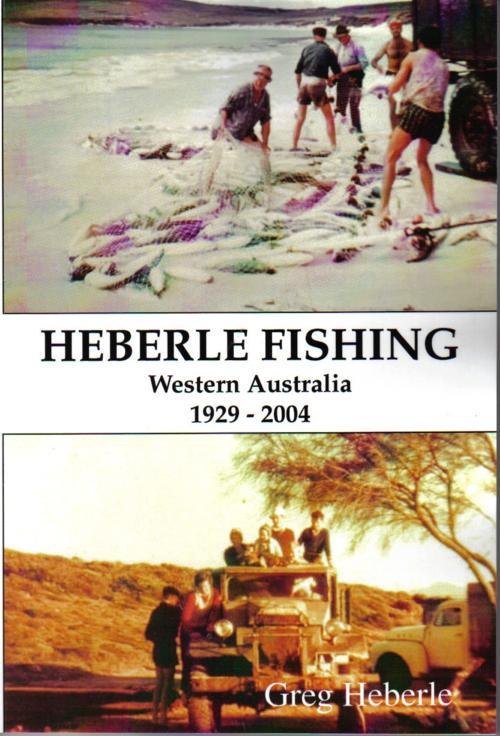
Link to Heberle Fishing
book.
Greg Heberle email [email protected]
References:
Cleve Hassell (1972) �The Hassells of Albany�
CALM, DEC, DPaW brochures for Fitzgerald National Park
Main Roads brochures covering work in Fitzgerald National
Park
Doubtful history website (Phil & Sigrid Wellstead)
Quaalup website
Martin Gibbs (2010) "The shore based whalers of Western
Australia"